Old Boundary Marker by Quarry Road, Winchester
Introduction
The photograph on this page of Old Boundary Marker by Quarry Road, Winchester by Milestone Society as part of the Geograph project.
The Geograph project started in 2005 with the aim of publishing, organising and preserving representative images for every square kilometre of Great Britain, Ireland and the Isle of Man.

There are currently over 7.5m images from over 14,400 individuals and you can help contribute to the project by visiting https://www.geograph.org.uk
Old Boundary Marker by Quarry Road, Winchester
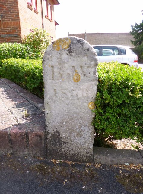
Image: © Milestone Society Taken: Unknown
Boundary Marker by the UC road, in parish of Winchester (Winchester District), Quarry Road, by Chilcomb Heights at back of pavement. Weathered inscription reads:- B.W. 18(??) Surveyed Milestone Society National ID: HA_WINBW01bm
Images are licensed for reuse under creativecommons.org/licenses/by-sa/2.0
Image Location
Latitude
51.058743
Longitude
-1.303657