IMAGES TAKEN NEAR TO
Bournefields, WINCHESTER, SO21 1NY
Introduction
This page details the photographs taken nearby to Bournefields, SO21 1NY by members of the Geograph project.
The Geograph project started in 2005 with the aim of publishing, organising and preserving representative images for every square kilometre of Great Britain, Ireland and the Isle of Man.

There are currently over 7.5m images from over14,400 individuals and you can help contribute to the project by visiting https://www.geograph.org.uk
Image Map
Images are licensed for reuse under creativecommons.org/licenses/by-sa/2.0
Notes
- Clicking on the map will re-center to the selected point.
- The higher the marker number, the further away the image location is from the centre of the postcode.
Image Listing (13 Images Found)
Images are licensed for reuse under creativecommons.org/licenses/by-sa/2.0
Image
Details
Distance
1
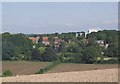
Bournefields housing with Northfields Farm feed mill, Twyford
Looking north. There has been much controversy over the feed mill and associated buildings which, whilst providing employment, are seen as inappropriate in a rural residential setting.
Image: © Peter Facey
Taken: 15 Aug 2005
0.05 miles
4
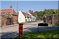
High Street
Showing position of Postbox No. SO21 25.
Image: © JThomas
Taken: 29 Apr 2022
0.21 miles
5
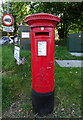
George VI postbox on High Street
Postbox No. SO21 25.
Image: © JThomas
Taken: 29 Apr 2022
0.22 miles

7
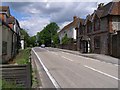
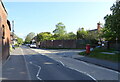
The B3335, North Town, Twyford
This is the main road through Twyford, which descends Cox's Hill on its way to the northbound Junction 11 of the M3 motorway. This view is from the top end of Church Lane.
Image: © Jim Champion
Taken: 29 May 2007
0.22 miles
9
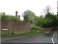
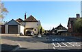
Bourne Lane joins the High Street, Twyford
Bourne Lane (right). The narrow Berry Lane (left above pillar box) goes to the church. Vine Cottage (beyond bus stop). Pemberley (righthand white house).
Image: © Peter Facey
Taken: 26 Sep 2008
0.22 miles
10
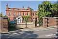
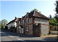
Twyford House
This may originally have been one large house but is now divided into three: Twyford House (left), Wing House (above righthand gate pillar), Well House (beyond the trees).
Image: © Peter Facey
Taken: 26 Sep 2008
0.24 miles