Twyford House
Introduction
The photograph on this page of Twyford House by Peter Facey as part of the Geograph project.
The Geograph project started in 2005 with the aim of publishing, organising and preserving representative images for every square kilometre of Great Britain, Ireland and the Isle of Man.

There are currently over 7.5m images from over 14,400 individuals and you can help contribute to the project by visiting https://www.geograph.org.uk
Twyford House
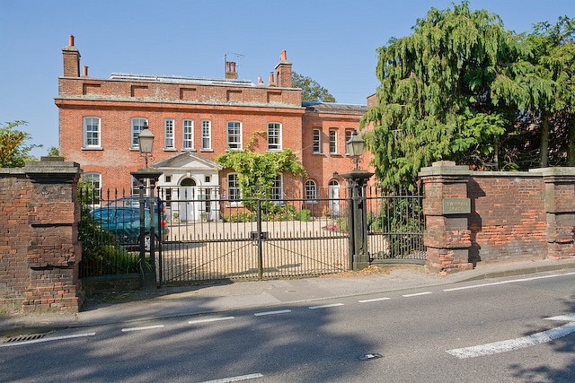
Image: © Peter Facey Taken: 26 Sep 2008
This may originally have been one large house but is now divided into three: Twyford House (left), Wing House (above righthand gate pillar), Well House (beyond the trees).
Images are licensed for reuse under creativecommons.org/licenses/by-sa/2.0
Image Location
Latitude
51.022893
Longitude
-1.313291