IMAGES TAKEN NEAR TO
Minstead Avenue, SOUTHAMPTON, SO18 5JF
Introduction
This page details the photographs taken nearby to Minstead Avenue, SO18 5JF by members of the Geograph project.
The Geograph project started in 2005 with the aim of publishing, organising and preserving representative images for every square kilometre of Great Britain, Ireland and the Isle of Man.

There are currently over 7.5m images from over14,400 individuals and you can help contribute to the project by visiting https://www.geograph.org.uk
Image Map
Images are licensed for reuse under creativecommons.org/licenses/by-sa/2.0
Notes
- Clicking on the map will re-center to the selected point.
- The higher the marker number, the further away the image location is from the centre of the postcode.
Image Listing (13 Images Found)
Images are licensed for reuse under creativecommons.org/licenses/by-sa/2.0
Image
Details
Distance
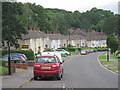
1
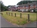
Housing and grassed area in Cheriton Avenue
Image: © David Martin
Taken: 26 Jun 2012
0.07 miles
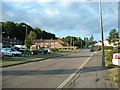
3
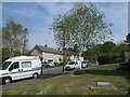
Tichborne Road, Harefield, Southampton
On the east side of Bramdean Road.
Image: © Christine Johnstone
Taken: 23 Apr 2022
0.12 miles
4
Breamore Road, Harefield, Southampton
On the west side of Bramdean Road.
Image: © Christine Johnstone
Taken: 23 Apr 2022
0.14 miles
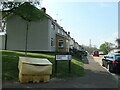
5
Bramdean Road, Harefield, Southampton
Descending into a small valley. Named after a Hampshire village.
Image: © Christine Johnstone
Taken: 23 Apr 2022
0.17 miles
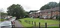
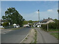
6
Cheriton Avenue, Harefield, Southampton
Harefield is predominantly 1950s design low density housing.
Image: © GaryReggae
Taken: 21 Jul 2005
0.17 miles
7
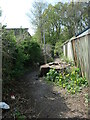
Path into woodland, off Bramdean Road
The anonymous woodland is public open space, criss-crossed with paths. It runs along a ridge, full of mature trees and surrounded by houses. It is a remnant of a much larger wood.
Image: © Christine Johnstone
Taken: 23 Apr 2022
0.18 miles
8
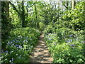
Woodland path with bluebells, Harefield, Southampton
The anonymous woodland is public open space, criss-crossed with paths. It runs along a ridge, full of mature trees and surrounded by houses. It is a remnant of a much larger wood.
Image: © Christine Johnstone
Taken: 23 Apr 2022
0.18 miles
10
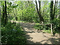
Woodland path junction, Harefield, Southampton
The anonymous woodland is public open space, criss-crossed with paths. It runs along a ridge, full of mature trees and surrounded by houses. It is a remnant of a much larger wood.
Image: © Christine Johnstone
Taken: 23 Apr 2022
0.20 miles