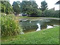
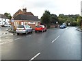
IMAGES TAKEN NEAR TO
South Street, MARLBOROUGH, SN8 2DW
Introduction
This page details the photographs taken nearby to South Street, SN8 2DW by members of the Geograph project.
The Geograph project started in 2005 with the aim of publishing, organising and preserving representative images for every square kilometre of Great Britain, Ireland and the Isle of Man.

There are currently over 7.5m images from over14,400 individuals and you can help contribute to the project by visiting https://www.geograph.org.uk
Image Map
Images are licensed for reuse under creativecommons.org/licenses/by-sa/2.0
Notes
- Clicking on the map will re-center to the selected point.
- The higher the marker number, the further away the image location is from the centre of the postcode.
Image Listing (53 Images Found)
Images are licensed for reuse under creativecommons.org/licenses/by-sa/2.0
Image
Details
Distance
1
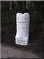
Old Milestone by the B4192, South Street, Aldbourne
Swindon half-round with base by the B4192, in parish of Aldbourne (Kennet District), South Street, Aldbourne, beside mini-roundabout at junction with Turnpike, opposite Malt House, in domestic shrubs behind footpath and beside rubbish bin.
For a photo taken a few days earlier before conservation, see https://www.flickr.com/photos/tollhouses/2914648473
Inscription reads:-
: TO / SWINDON / 9 / Miles : : TO / LONDON / 72 Miles : : TO / HUNGERFORD / 7 / Miles :
Grade II listed.
List Entry Number: 1200062 https://historicengland.org.uk/listing/the-list/list-entry/1200062
Surveyed
Milestone Society National ID: WI_HGSN07
Image: © Alan Rosevear
Taken: 25 Mar 2005
0.04 miles
2
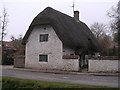
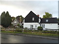
Old Toll House by the B4192, South Street, Aldbourne
Toll House by the B4192, in parish of Aldbourne (Kennet District), Turnpike Cottage, No. 8, South Street, SN8 2BZ.
Grade II listed.
List Entry Number: 1200054 https://historicengland.org.uk/listing/the-list/list-entry/1200054
Surveyed
Milestone Society National ID: WI.ALD02
Image: © Alan Rosevear
Taken: Unknown
0.08 miles
4
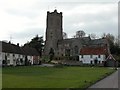
Church of St. Michael, Aldbourne
A wooden church was established her in 966. By the 12th C there was a stone church which was destroyed by fire, the current church was built around 1220.
Image: © Martyn Pattison
Taken: 12 Apr 2005
0.11 miles
5
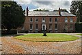
The Old Manor, Aldbourne
The Old Manor, formerly the Old Rectory
Grade II listed - https://historicengland.org.uk/listing/the-list/list-entry/1034167
Image: © Steve Roberts
Taken: 16 Sep 2021
0.12 miles
7
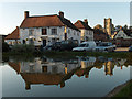
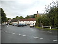
The Square, Aldbourne
The Crown Hotel and St Michael's Church.
Image: © Andrew Smith
Taken: 24 Oct 2006
0.13 miles
8
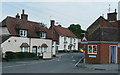
Aldbourne village centre
A nuclear (in the geographical sense) village in a fine valley-bottom position mid-way between Swindon and Hungerford.
See; http://www.aldbourne.org.uk/awg/portal/main/welcome.asp
Image: © Jonathan Billinger
Taken: 22 May 2008
0.13 miles