Old Milestone by the B4192, South Street, Aldbourne
Introduction
The photograph on this page of Old Milestone by the B4192, South Street, Aldbourne by Alan Rosevear as part of the Geograph project.
The Geograph project started in 2005 with the aim of publishing, organising and preserving representative images for every square kilometre of Great Britain, Ireland and the Isle of Man.

There are currently over 7.5m images from over 14,400 individuals and you can help contribute to the project by visiting https://www.geograph.org.uk
Old Milestone by the B4192, South Street, Aldbourne
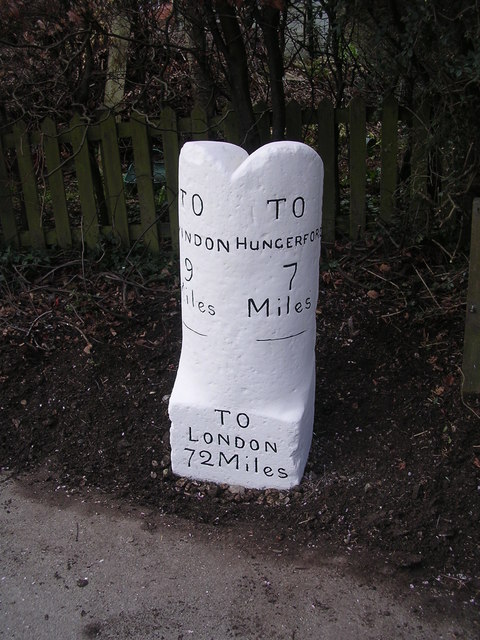
Image: © Alan Rosevear Taken: 25 Mar 2005
Swindon half-round with base by the B4192, in parish of Aldbourne (Kennet District), South Street, Aldbourne, beside mini-roundabout at junction with Turnpike, opposite Malt House, in domestic shrubs behind footpath and beside rubbish bin. For a photo taken a few days earlier before conservation, see https://www.flickr.com/photos/tollhouses/2914648473 Inscription reads:- : TO / SWINDON / 9 / Miles : : TO / LONDON / 72 Miles : : TO / HUNGERFORD / 7 / Miles : Grade II listed. List Entry Number: 1200062 https://historicengland.org.uk/listing/the-list/list-entry/1200062 Surveyed Milestone Society National ID: WI_HGSN07
Images are licensed for reuse under creativecommons.org/licenses/by-sa/2.0
Image Location
Latitude
51.477936
Longitude
-1.618055