
IMAGES TAKEN NEAR TO
Ypres Road, SWINDON, SN4 0JF
Introduction
This page details the photographs taken nearby to Ypres Road, SN4 0JF by members of the Geograph project.
The Geograph project started in 2005 with the aim of publishing, organising and preserving representative images for every square kilometre of Great Britain, Ireland and the Isle of Man.

There are currently over 7.5m images from over14,400 individuals and you can help contribute to the project by visiting https://www.geograph.org.uk
Image Map
Images are licensed for reuse under creativecommons.org/licenses/by-sa/2.0
Notes
- Clicking on the map will re-center to the selected point.
- The higher the marker number, the further away the image location is from the centre of the postcode.
Image Listing (12 Images Found)
Images are licensed for reuse under creativecommons.org/licenses/by-sa/2.0
Image
Details
Distance
1
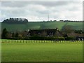
South Farm, Chiseldon, Swindon
The mast on the skyline is at SU208765 on top of the escarpment.
Image: © Brian Robert Marshall
Taken: 19 Jan 2007
0.02 miles
2
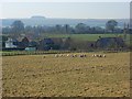
South Farm, Chiseldon
A view across pastures from the Chiseldon and Marlborough Railway Path. The Marlborough Downs provide the backdrop with (I think) Four Mile Clump prominent.
Image: © Andrew Smith
Taken: 16 Feb 2008
0.02 miles
3
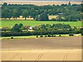
South Farm, Chiseldon, Swindon
South farm is the collective name for the cluster of buildings in the centre of the image. The white van at the extreme right indicates the line of an old Roman Road now the modern A346.
Image: © Brian Robert Marshall
Taken: 12 Aug 2014
0.02 miles
4
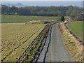
Quebec Road, Chiseldon
Heading west from the old railway. A mound of earth prevents access through here but gave a little elevation to this view.
Image: © Andrew Smith
Taken: 16 Feb 2008
0.08 miles
5
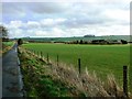
Quebec Road, Chiseldon, Swindon
The road leads to the old M&SWR trackbed now part of the national cycle network. South Farm is at centre-right of the image.
Image: © Brian Robert Marshall
Taken: 19 Jan 2007
0.14 miles
6
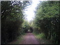
Cycle track on old railway track, heading north
Image: © Rob Purvis
Taken: 10 Jul 2011
0.18 miles
7

Former caravan site, near South Farm
Still marked as a caravan site on the online OS map, who knows what it is used for now? The graffiti reads: "Suncream Team". Note the toys at the left of the gate.
Image: © Vieve Forward
Taken: 30 Jul 2016
0.19 miles
8
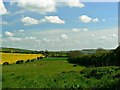
Former 'L' Lines, Chiseldon Camp, Chiseldon, Swindon
The field in view is currently pasture. It is situated between an old railway trackbed out of view behind the hedge on the right, and the A346 road to Burbage, south of Marlborough. In 1917 the field was the location of a specialist hospital for the treatment of soldiers who had contracted conditions then collectively called venereal disease (VD) and now known as sexually transmitted infections (STIs). The sufferers probably called them other things. Treatment in those pre-penicillin days was somewhat hit or miss. One measure involved the use of arsenic injections until it was found that the cure tended to be fatal. Locally 'L' Lines was known as the 'bad boys' camp'. Although it was supposed to be secure there were incidents of soldiers getting out and visiting the brothels of Swindon. More about it here http://www.swindonweb.com/?m=8&s=116&ss=763&c=2501&t=Chiseldon+Camp and here http://www.bbc.co.uk/news/uk-england-25040585
Image: © Brian Robert Marshall
Taken: 9 May 2014
0.20 miles
9
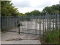
Secure storage area, hidden from public view
Marked as a caravan site on the OS map! I don't think so. This is tucked away from public view in a dip behind the old railway track, which is now a cycle path.
Image: © Rob Purvis
Taken: 10 Jul 2011
0.23 miles
10
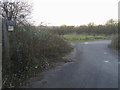
National Cycle Way 482
National Cycle Way 482 heading to Chiseldon
Image: © Shaun Ferguson
Taken: 29 Dec 2013
0.23 miles