IMAGES TAKEN NEAR TO
Hathersage Moor, SWINDON, SN3 6NW
Introduction
This page details the photographs taken nearby to Hathersage Moor, SN3 6NW by members of the Geograph project.
The Geograph project started in 2005 with the aim of publishing, organising and preserving representative images for every square kilometre of Great Britain, Ireland and the Isle of Man.

There are currently over 7.5m images from over14,400 individuals and you can help contribute to the project by visiting https://www.geograph.org.uk
Image Map
Images are licensed for reuse under creativecommons.org/licenses/by-sa/2.0
Notes
- Clicking on the map will re-center to the selected point.
- The higher the marker number, the further away the image location is from the centre of the postcode.
Image Listing (106 Images Found)
Images are licensed for reuse under creativecommons.org/licenses/by-sa/2.0
Image
Details
Distance
1
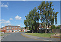
Hallam Moor, Liden
Junction of Hallam Moor and White Edge Moor. The wooden fence on the left protects the estate from the noise of the traffic on the Stratton St. Margaret Bypass (A 419T).
Image: © Vieve Forward
Taken: 28 Dec 2012
0.07 miles
2
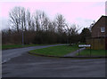
North-bound slip road from Commonhead to the A419
Following a five-vehicle road traffic accident further north along the A419 at around 09.30 BST on this day the north-bound carriageway was closed for about nine hours and traffic was prevented from entering at the Commonhead intersection. This photo was taken at 15.55.
Image: © Brian Robert Marshall
Taken: 26 Aug 2021
0.09 miles
3
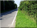
Wick Lane, Liden, Swindon (1)
Until the late 1960s Wick Lane was a minor road between the Marlborough Road and Ermin Street (or Ermin Way). At that time the area was taken over by Swindon Borough Council for the next phase in its expansion called the South Dorcan Extension. the extension was developed over the following 15 years or so. At the same time Wick Lane became redundant as a highway with the building of the A419 dual carriageway and is now a footpath and cycleway through housing on the eastern side of the developed area. This is a view looking north.
Image: © Brian Robert Marshall
Taken: 5 Feb 2009
0.10 miles
4
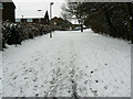
Wick Lane, Liden, Swindon (2)
Until the late 1960s Wick Lane was a minor road between the Marlborough Road and Ermin Street (or Ermin Way). At that time the area was taken over by Swindon Borough Council for the next phase in its expansion called the South Dorcan Extension. the extension was developed over the following 15 years or so. At the same time Wick Lane became redundant as a highway with the building of the A419 dual carriageway and is now a footpath and cycleway through housing on the eastern side of the developed area. This is a view looking south.
Image: © Brian Robert Marshall
Taken: 5 Feb 2009
0.10 miles
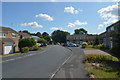
6
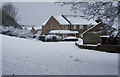
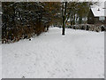
Matley Moor from Wick Lane, Swindon
An unusually heavy fall of snow overnight has transformed the appearance of the area. The road names of this part of Liden are, I believe, taken from areas in Derbyshire.
Image: © Brian Robert Marshall
Taken: 6 Jan 2010
0.12 miles
7

Towards Moor Leaze, Swindon
The A419 is just out of shot to the left. Moor Leaze is a diversified farm whose enterprises include a dancing school.
Image: © Brian Robert Marshall
Taken: 7 Feb 2009
0.14 miles
8
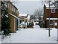
Tansley Moor near Wick Lane, Liden, Swindon
The houses here are in Tansley Moor, part of the South Dorcan Extension, developed in the 1970s and 80s.
Image: © Brian Robert Marshall
Taken: 5 Feb 2009
0.15 miles
9

A view east along Marlborough Road, Swindon, Wiltshire
This stretch of Marlborough Road was widened some years ago partly to accommodate an entrance to a new hospital, the Great Western, and to provide additional capacity for this major route into Swindon from both the M4 and M5 motorways which are connected by the A419, out of view behind the trees in the background.
Image: © Brian Robert Marshall
Taken: 11 May 2012
0.15 miles