
IMAGES TAKEN NEAR TO
Homington Avenue, SWINDON, SN3 6FJ
Introduction
This page details the photographs taken nearby to Homington Avenue, SN3 6FJ by members of the Geograph project.
The Geograph project started in 2005 with the aim of publishing, organising and preserving representative images for every square kilometre of Great Britain, Ireland and the Isle of Man.

There are currently over 7.5m images from over14,400 individuals and you can help contribute to the project by visiting https://www.geograph.org.uk
Image Map
Images are licensed for reuse under creativecommons.org/licenses/by-sa/2.0
Notes
- Clicking on the map will re-center to the selected point.
- The higher the marker number, the further away the image location is from the centre of the postcode.
Image Listing (35 Images Found)
Images are licensed for reuse under creativecommons.org/licenses/by-sa/2.0
Image
Details
Distance
1

Great Western Hospital, Swindon, Wiltshire
The Great Western Hospital opened in 2001. It is an example of a hospital provided under the Private Finance Initiative. It replaced the Princess Margaret Hospital (now demolished) built in 1958 and deemed obsolete after fewer than 40 years.
Image: © Brian Robert Marshall
Taken: 2 Oct 2006
0.13 miles
2
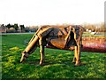
Cow, Great Western Hospital, Swindon
Before the GWH opened in 2001, the region was served by the Princess Margaret Hospital in Okus Road, Swindon. The PMH is no more having been recently demolished. This sculpture was originally at the PMH. Just behind the cow is the hospital's flood storage lagoon, home to swans, coots and mallard. The vehicle in the background is heading towards Swindon on the A4259.
Image: © Brian Robert Marshall
Taken: 4 Feb 2007
0.16 miles
3
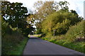
Day House Lane
The footpath entrance seen here is northwest of the position shown on the Ordnance Survey map, which has been subject to long-term closure to make way for new housing development.
Image: © David Martin
Taken: 21 Oct 2016
0.16 miles
4
![Badbury Park [4]](https://s2.geograph.org.uk/geophotos/05/11/04/5110462_12b3d9c1_120x120.jpg)
Badbury Park [4]
A huge housing estate is being built on land adjoining the Great Western Hospital. Here, at a distant part of the site, the perimeter fencing has blocked a public footpath from Day House Lane.
Image: © Michael Dibb
Taken: 31 Aug 2016
0.17 miles
5
![Great Western Hospital [1]](https://s1.geograph.org.uk/geophotos/05/11/04/5110453_461517e5_120x120.jpg)
Great Western Hospital [1]
This large hospital (almost 600,000 sq ft) was completed in 2002. It replaced the Princess Margaret Hospital, which had served the town since 1959.
Image: © Michael Dibb
Taken: 31 Aug 2016
0.17 miles
6
![Great Western Hospital [2]](https://s2.geograph.org.uk/geophotos/05/11/04/5110454_7a8d1f64_120x120.jpg)
Great Western Hospital [2]
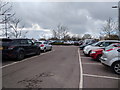
This large hospital is always busy and parking can be problematical even with the large car park of which this is only a small section.
Image: © Michael Dibb
Taken: 31 Aug 2016
0.17 miles
7
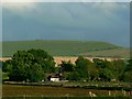
Bungalow, Day House Lane, Swindon
Day House Lane is an old road that leads from the Richard Jefferies museum http://www.geograph.org.uk/photo/252496 to Badbury Wick and Medbourne. On the skyline is an Iron Age hill fort at Liddington Hill.
Image: © Brian Robert Marshall
Taken: 13 May 2007
0.18 miles
8
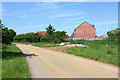
New Build
New housing next to Day House Lane.
Image: © Wayland Smith
Taken: 9 May 2020
0.18 miles
10
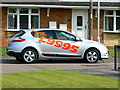
Renault Megane and a cat, Liden, Swindon
The cat is harder to spot than the Renault dealer's apostrophe.
Image: © Brian Robert Marshall
Taken: 15 Sep 2011
0.19 miles