
IMAGES TAKEN NEAR TO
Marlborough Road, SWINDON, SN3 1NR
Introduction
This page details the photographs taken nearby to Marlborough Road, SN3 1NR by members of the Geograph project.
The Geograph project started in 2005 with the aim of publishing, organising and preserving representative images for every square kilometre of Great Britain, Ireland and the Isle of Man.

There are currently over 7.5m images from over14,400 individuals and you can help contribute to the project by visiting https://www.geograph.org.uk
Image Map
Images are licensed for reuse under creativecommons.org/licenses/by-sa/2.0
Notes
- Clicking on the map will re-center to the selected point.
- The higher the marker number, the further away the image location is from the centre of the postcode.
Image Listing (22 Images Found)
Images are licensed for reuse under creativecommons.org/licenses/by-sa/2.0
Image
Details
Distance
2
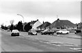
Marlborough Road - junction with Windsor Road
Marlborough Road is one of the main routes out of Swindon, as it connects the area known as Old Town to the route to the M4 motorway. The road on the right, Windsor Road, is the busy main road through the Lawn residential estate and comes out on the dual carriageway road, Queen's Drive. Right turns from Windsor Road into Marlborough Road were always difficult, but since this picture was taken in 1983, a mini-roundabout has been installed here. Note the Mini coming along Marlborough Road; a very popular car at the time. The view in the other direction:- Image
Image: © P L Chadwick
Taken: 19 Jan 1983
0.03 miles
3
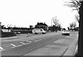
Marlborough Road - junction with Windsor Road
A view of this difficult junction, from the opposite direction to this:- Image Today there is a mini-roundabout here. A traffic feature that Swindon is very addicted to, often when you least expect it. The van waiting to turn out of Windsor Road belonged to the well-known Empire Stores.
Image: © P L Chadwick
Taken: 19 Jan 1983
0.03 miles
4
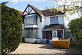
#252 Marlborough Road
There is an OS benchmark Image on the right hand side of the house
Image: © Roger Templeman
Taken: 22 Apr 2015
0.06 miles
5

Benchmark on #252 Marlborough Road
Ordnance Survey cut mark benchmark described on the Bench Mark Database at http://www.bench-marks.org.uk/bm66427
Image: © Roger Templeman
Taken: 22 Apr 2015
0.07 miles
6
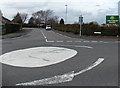
Windsor Road mini-roundabout, Lawn, Swindon
Looking north towards Windsor Road across a mini-roundabout in Marlborough Road.
Lawn Primary School is ahead.
Image: © Jaggery
Taken: 14 Apr 2013
0.07 miles
7
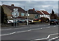
Lawn district boundary sign, Swindon
Located alongside Marlborough Road opposite the Downs View Road junction.
Image: © Jaggery
Taken: 14 Apr 2013
0.08 miles
8
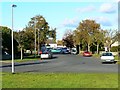
Downs View Road, Swindon
The road is a cul-de-sac. For such a configuration it is unusually wide. I have heard it said that, when the road was planned, the intention was to take it to the south-west, over the railway that then existed and Broome Manor Lane thus forming a relief road round Old Town. Unfortunately for the planners, someone neglected to obtain the necessary permissions or wayleaves from the landowner and the scheme came to nothing. A further legacy is a wide area of green space, the edge of which is visible in the foreground, between the houses on either side, which were built in the 1930s. The bus in the background is in Marlborough Road on its way into Old Town, Swindon.
Image: © Brian Robert Marshall
Taken: 30 Oct 2007
0.09 miles
9

Lawn Primary School
There is an OS benchmark Image on the bricks right of the orange hexagon
Image: © Roger Templeman
Taken: 22 Apr 2015
0.10 miles
10
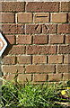
Benchmark on Lawn Primary School
Ordnance Survey cut mark benchmark described on the Bench Mark Database at http://www.bench-marks.org.uk/bm66429
Image: © Roger Templeman
Taken: 22 Apr 2015
0.11 miles