
IMAGES TAKEN NEAR TO
Ashwell Close, SWINDON, SN3 1DY
Introduction
This page details the photographs taken nearby to Ashwell Close, SN3 1DY by members of the Geograph project.
The Geograph project started in 2005 with the aim of publishing, organising and preserving representative images for every square kilometre of Great Britain, Ireland and the Isle of Man.

There are currently over 7.5m images from over14,400 individuals and you can help contribute to the project by visiting https://www.geograph.org.uk
Image Map
Images are licensed for reuse under creativecommons.org/licenses/by-sa/2.0
Notes
- Clicking on the map will re-center to the selected point.
- The higher the marker number, the further away the image location is from the centre of the postcode.
Image Listing (22 Images Found)
Images are licensed for reuse under creativecommons.org/licenses/by-sa/2.0
Image
Details
Distance
1
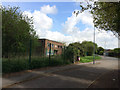
The Old Pumping Station, Walcot Road
Empty and derelict brick building which used to be a pumping station. The first building in the area, before the surrounding houses started to be built in 1956.
Image: © Tom Slists
Taken: 24 Apr 2014
0.10 miles
2
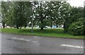
Queen's Drive, Swindon
The streaks are torrential rain which lasted around an hour and flooded many roads to the east.
Image: © David Howard
Taken: 11 Jun 2023
0.15 miles
3
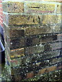
Benchmark on block of flats #215-221 Queens Drive
Ordnance Survey cut mark benchmark described on the Bench Mark Database at http://www.bench-marks.org.uk/bm37325
Image: © Roger Templeman
Taken: 18 Mar 2011
0.16 miles
4
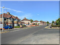
Upham Road
c.1930s housing in Upham Road in the Walcot West suburb of Swindon.
Image: © Ian Capper
Taken: 14 Jul 2022
0.19 miles
5
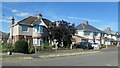
Houses on the north side of Walcot Road, Walcot West
Built just after the Second World War, when they were at the eastern edge of Swindon.
Image: © Christine Johnstone
Taken: 14 Jul 2022
0.20 miles

8
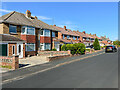
Thurlestone Road
c.1960s? housing in Upham Road in the Walcot West suburb of Swindon.
Image: © Ian Capper
Taken: 14 Jul 2022
0.20 miles
9
Queen's Drive, Swindon
Churchfield's Academy is hiding behind the railings
Image: © David Howard
Taken: 9 Sep 2018
0.20 miles
10
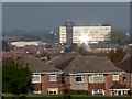
Falmouth Grove, Swindon
Falmouth Grove is part of the Walcot West area of private housing developed in the years before and after the second world war. The houses visible here would have been built in the 1960s. Beyond is the UK headquarters of the well-known retailer, W H Smith in SU1785 over two kilometres away to the north-east and the subject of this image Image
Image: © Brian Robert Marshall
Taken: 23 Oct 2007
0.22 miles