
IMAGES TAKEN NEAR TO
Ferndale Road, SWINDON, SN2 1EX
Introduction
This page details the photographs taken nearby to Ferndale Road, SN2 1EX by members of the Geograph project.
The Geograph project started in 2005 with the aim of publishing, organising and preserving representative images for every square kilometre of Great Britain, Ireland and the Isle of Man.

There are currently over 7.5m images from over14,400 individuals and you can help contribute to the project by visiting https://www.geograph.org.uk
Image Map
Images are licensed for reuse under creativecommons.org/licenses/by-sa/2.0
Notes
- Clicking on the map will re-center to the selected point.
- The higher the marker number, the further away the image location is from the centre of the postcode.
Image Listing (150 Images Found)
Images are licensed for reuse under creativecommons.org/licenses/by-sa/2.0
Image
Details
Distance
1
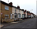
Houses on the south side of Ferndale Road, Gorse Hill, Swindon
Looking west from the Cricklade Road end.
Image: © Jaggery
Taken: 1 Dec 2014
0.03 miles
2
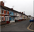
Florence Street towards Ferndale Road, Swindon
Houses on the west side of Florence Street viewed from the corner of Whiteman Street
looking north towards Ferndale Road. Florence Street Mission Hall http://www.geograph.org.uk/photo/4265807 is nearby.
Image: © Jaggery
Taken: 1 Dec 2014
0.04 miles
3
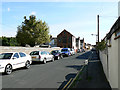
Florence Street, Swindon
This is a view south along the Victorian street. The building on the left is a little unusual. It may once have been a chapel. There is a closer look here Image and another view here Image
Image: © Brian Robert Marshall
Taken: 11 Sep 2009
0.06 miles
4
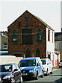
Premises, Florence Street, Swindon
This building may once have been a chapel. It has an ecclesiastical appearance. Now it has a rather more prosaic use. The rating lists describe it as a 'workshop and premises'.
Image: © Brian Robert Marshall
Taken: 11 Sep 2009
0.06 miles
5
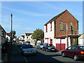
Florence Street, Swindon
This is a view north towards Ferndale Road. The tall building at the right is seen from the opposite direction in this image Image Despite its ecclesiastical appearance it is a workshop.
Image: © Brian Robert Marshall
Taken: 11 Sep 2009
0.06 miles
6
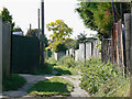
Alley between Norman Road and Malvern Road, Swindon
Norman Road is to the left. Most alleys in Swindon, and there are many in the older parts of the town, are metalled. This one isn't which suggests it has not been adopted. I believe Norman Road was built in the 1920s and, when completed, the backs of the houses on the northern side would have faced open fields with easy access to the back gardens. Malvern Road is a decade or so younger so I would surmise that this alley was left to enable access to the back gardens of Norman Road to continue.
Image: © Brian Robert Marshall
Taken: 11 Sep 2009
0.08 miles
7
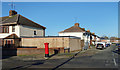
Corner of Norman Road
I passed several Royal Mail post boxes on my walk today. Most of them seemed to be leaning a bit.
Image: © Des Blenkinsopp
Taken: 19 Jan 2020
0.08 miles
8
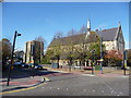
Swindon : Cricklade Road & St. Barnabas Church
A church in Swindon on Cricklade Road.
Image: © Lewis Clarke
Taken: 22 Oct 2008
0.08 miles
9
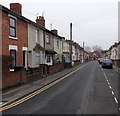
Whiteman Street, Swindon
Looking west from the corner of Poulton Street. http://www.geograph.org.uk/photo/4265818
Florence Street Mission Hall http://www.geograph.org.uk/photo/4265807 is in the distance.
Image: © Jaggery
Taken: 1 Dec 2014
0.08 miles
10
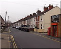
West along Whiteman Street, Swindon
Whiteman Street extends for 250 metres from Cricklade Road behind the camera to Florence Street Mission Hall http://www.geograph.org.uk/photo/4265807 in the distance. A side entrance http://www.geograph.org.uk/photo/4362796 to Mbros is on the right.
Image: © Jaggery
Taken: 1 Dec 2014
0.08 miles