
IMAGES TAKEN NEAR TO
Malvern Road, SWINDON, SN2 1AR
Introduction
This page details the photographs taken nearby to Malvern Road, SN2 1AR by members of the Geograph project.
The Geograph project started in 2005 with the aim of publishing, organising and preserving representative images for every square kilometre of Great Britain, Ireland and the Isle of Man.

There are currently over 7.5m images from over14,400 individuals and you can help contribute to the project by visiting https://www.geograph.org.uk
Image Map
Images are licensed for reuse under creativecommons.org/licenses/by-sa/2.0
Notes
- Clicking on the map will re-center to the selected point.
- The higher the marker number, the further away the image location is from the centre of the postcode.
Image Listing (124 Images Found)
Images are licensed for reuse under creativecommons.org/licenses/by-sa/2.0
Image
Details
Distance
1
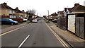
West along Malvern Road, Gorse Hill, Swindon
From the Cricklade Road end.
Image: © Jaggery
Taken: 1 Dec 2014
0.02 miles
2
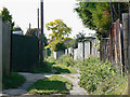
Alley between Norman Road and Malvern Road, Swindon
Norman Road is to the left. Most alleys in Swindon, and there are many in the older parts of the town, are metalled. This one isn't which suggests it has not been adopted. I believe Norman Road was built in the 1920s and, when completed, the backs of the houses on the northern side would have faced open fields with easy access to the back gardens. Malvern Road is a decade or so younger so I would surmise that this alley was left to enable access to the back gardens of Norman Road to continue.
Image: © Brian Robert Marshall
Taken: 11 Sep 2009
0.04 miles
3
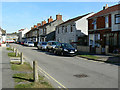
Norman Road and St Paul's Street, Swindon
Norman Road runs into St Paul's Street at a point just behind the third car on the right. St Paul's Street was built in the late 19th century and old maps from that era show it. Norman Road was developed in the 20th century, probably in the years before and after the Great War. The bus in the distance is in Cricklade Road.
Image: © Brian Robert Marshall
Taken: 11 Sep 2009
0.04 miles
4
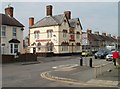
The Duke of Edinburgh, Swindon
Pub with accommodation available. Located on Cricklade Road, viewed from the corner of Edinburgh Street.
The pub dates from 1874, occupying the site of a beerhouse which had opened in 1859.
Image: © Jaggery
Taken: 12 Mar 2011
0.05 miles
5
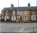
Swindon : Cricklade Road houses opposite Edinburgh Street
Viewed from the western edge of Edinburgh Street. http://www.geograph.org.uk/photo/2325149
Between the two upstairs windows, the lighter-coloured house has a horseshoe-shaped inscription "Edinburgh Terrace". This street no longer exists: the houses are numbered in the Cricklade Road sequence.
Image: © Jaggery
Taken: 12 Mar 2011
0.05 miles
6
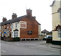
ARKELLS BBB, Cricklade Road, Swindon
The wall is at the entrance to The Duke of Edinburgh http://www.geograph.org.uk/photo/2325145 car park.
Arkells Best Bitter Beer, first brewed in 1910, is often referred to as BBB or 3B. According to one Swindon landlord, BBB stands for Big Boys' Beer.
Image: © Jaggery
Taken: 12 Mar 2011
0.05 miles
7
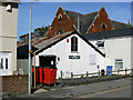
Playgroup, St Paul's Street, Swindon
The playgroup occupies what was once a 'tin tabernacle'. I don't know much about the history of the building but I suspect it was the original Gorse Hill Methodist Church which is the rather more substantial building behind it.
Image: © Brian Robert Marshall
Taken: 11 Sep 2009
0.05 miles
8
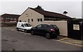
Legends contractors accommodation in Swindon
Behind the Duke of Edinburgh. http://www.geograph.org.uk/photo/4354136
Image: © Jaggery
Taken: 1 Dec 2014
0.06 miles
9
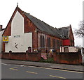
Derelict former Methodist church in Cricklade Road, Gorse Hill, Swindon
Viewed in early December 2014 when there is a SOLD sticker on the FREEHOLD FOR SALE board on the wall. The building was latterly used as the Bangladeshi Youth and Community Centre.
Image: © Jaggery
Taken: 1 Dec 2014
0.06 miles
10
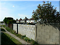
Rear of Malvern Road, Swindon
Malvern Road contains typical 1930s semi-detached houses. When originally built they had rather attractive art deco steel-framed windows. I think they have all been replaced. The alley in the foreground separates Malvern Road from Norman Road, out of shot to the left.
Image: © Brian Robert Marshall
Taken: 11 Sep 2009
0.06 miles