Norman Road and St Paul's Street, Swindon
Introduction
The photograph on this page of Norman Road and St Paul's Street, Swindon by Brian Robert Marshall as part of the Geograph project.
The Geograph project started in 2005 with the aim of publishing, organising and preserving representative images for every square kilometre of Great Britain, Ireland and the Isle of Man.

There are currently over 7.5m images from over 14,400 individuals and you can help contribute to the project by visiting https://www.geograph.org.uk
Norman Road and St Paul's Street, Swindon
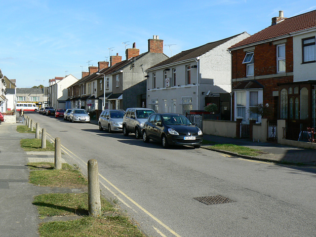
Image: © Brian Robert Marshall Taken: 11 Sep 2009
Norman Road runs into St Paul's Street at a point just behind the third car on the right. St Paul's Street was built in the late 19th century and old maps from that era show it. Norman Road was developed in the 20th century, probably in the years before and after the Great War. The bus in the distance is in Cricklade Road.
Images are licensed for reuse under creativecommons.org/licenses/by-sa/2.0
Image Location
Latitude
51.572839
Longitude
-1.77832