
IMAGES TAKEN NEAR TO
Hardenhuish Lane, CHIPPENHAM, SN14 6HL
Introduction
This page details the photographs taken nearby to Hardenhuish Lane, SN14 6HL by members of the Geograph project.
The Geograph project started in 2005 with the aim of publishing, organising and preserving representative images for every square kilometre of Great Britain, Ireland and the Isle of Man.

There are currently over 7.5m images from over14,400 individuals and you can help contribute to the project by visiting https://www.geograph.org.uk
Image Map
Images are licensed for reuse under creativecommons.org/licenses/by-sa/2.0
Notes
- Clicking on the map will re-center to the selected point.
- The higher the marker number, the further away the image location is from the centre of the postcode.
Image Listing (16 Images Found)
Images are licensed for reuse under creativecommons.org/licenses/by-sa/2.0
Image
Details
Distance
1
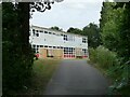
Sheldon School, Chippenham
A view through the gates at the rear entrance on Hardenhuish Lane. The school, originally for boys only, is now a co-educational comprehensive and claims to be the largest school in Wiltshire.
Image: © Stephen Craven
Taken: 13 Jul 2022
0.15 miles
2
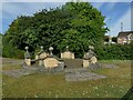
The stone circle on Redwing Avenue
I wondered whether this structure in a modern housing estate might be formed from parts of some historic house that once stood on the site, but a local person explained that the show houses for the estate were close by, and this was part of the developer's promotional work.
Image: © Stephen Craven
Taken: 15 Jul 2022
0.17 miles
3
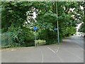
Cycleway off Hardenhuish Lane
Part of a longer foot and cycle path that runs for 1.3km alongside the Hardenhuish Brook from the ring road to Bristol Road on the outskirts of the town centre.
Image: © Stephen Craven
Taken: 13 Jul 2022
0.18 miles
4
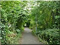
Link path off Stainers Way
This short, straight section of footpath connects the housing estate to a longer foot and cycle path that runs for 1.3km alongside the Hardenhuish Brook from the ring road to Bristol Road on the outskirts of the town centre.
Image: © Stephen Craven
Taken: 13 Jul 2022
0.18 miles
5
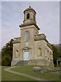
St Nicholas church, Hardenhuish
This distinctive church, on a hill overlooking the school, was built in 1779. Its classical Georgian style is the result of architect John Wood (the younger); Wood is renowned for his designs of The Royal Crescent and The Circus in Bath. Also of note is the Ricardo Monument - containing the tombs of nine of the family from whom David (famed for his immense financial standing in the Stock Exchange) came from.
Image: © Neil Owen
Taken: 29 Feb 2012
0.18 miles
6
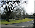
2010 : New housing estate near Hardenhuish
Proof, if proof is needed that modern housing estates do not need to be ugly monstrosities. A little careful and sympathetic planning goes a long way.
West of Chippenham.
Image: © Maurice Pullin
Taken: 16 Mar 2010
0.19 miles
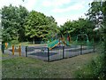
8
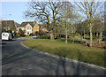
2010 : Sandown Drive, Chippenham
A modern housing estate west of Chippenham, handy for the A420 and the western bypass.
Image: © Maurice Pullin
Taken: 16 Mar 2010
0.20 miles
9
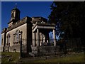
Tomb of 19th century economist David Ricardo
Stands by the south-east corner of Hardenhuish Church.
Image: © tristan forward
Taken: 21 Feb 2009
0.21 miles
10
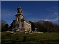
Hardenhuish Church
Designed by John Wood.
Tomb of 19th century economist David Ricardo at the right.
Image: © tristan forward
Taken: 21 Feb 2009
0.21 miles