
IMAGES TAKEN NEAR TO
Cricklade Court, Cricklade Street, SWINDON, SN1 3EY
Introduction
This page details the photographs taken nearby to Cricklade Court, Cricklade Street, SN1 3EY by members of the Geograph project.
The Geograph project started in 2005 with the aim of publishing, organising and preserving representative images for every square kilometre of Great Britain, Ireland and the Isle of Man.

There are currently over 7.5m images from over14,400 individuals and you can help contribute to the project by visiting https://www.geograph.org.uk
Image Map
Images are licensed for reuse under creativecommons.org/licenses/by-sa/2.0
Notes
- Clicking on the map will re-center to the selected point.
- The higher the marker number, the further away the image location is from the centre of the postcode.
Image Listing (303 Images Found)
Images are licensed for reuse under creativecommons.org/licenses/by-sa/2.0
Image
Details
Distance
1
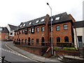
Cricklade Court, Swindon
Offices in Cricklade Street.
Image: © Jaggery
Taken: 14 Apr 2013
0.01 miles
2
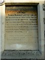
Plaque, Anderson's Hostel, Cricklade Street, Swindon
The plaque is to be found on the western elevation of a small row of dwellings now rather more prosaically addressed as 27-30 Cricklade Street. The term 'second poor' apparently refers to folk who were parishioners and who were not receiving relief from the parish. http://archiver.rootsweb.ancestry.com/th/read/Bristol_and_Somerset/2003-05/1052087753 The building to which the plaque is attached is shown here http://www.geograph.org.uk/photo/1113394
Image: © Brian Robert Marshall
Taken: 9 Jan 2009
0.01 miles
3
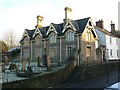
Anderson's Hostel, Cricklade Street, Swindon
The building dates to 1877 and was built as a hostel for the 'second poor'. There is more information here http://www.geograph.org.uk/photo/1113380 In front of the dwellings is the churchyard of Christ Church.
Image: © Brian Robert Marshall
Taken: 9 Jan 2009
0.01 miles
4
![Old Town buildings [33]](https://s0.geograph.org.uk/geophotos/06/09/75/6097536_53c27792_120x120.jpg)
Old Town buildings [33]
Seen from the churchyard of Christ Church, Andersons Hostel was built in 1877 as almshouses. Listed, grade II, with details at: https://historicengland.org.uk/listing/the-list/list-entry/1283745
Image: © Michael Dibb
Taken: 16 Feb 2019
0.01 miles
5
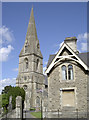
Christ Church and the hostel
Christ Church was built in 1851 to the designs of Sir George Gilbert Scott and embellished in Midlands Decorated style. It replaced an older and by then inadequate Holy Rood church; local landowner Ambrose Goddard donated this piece of hillside land to meet the needs of a growing Swindon population.
The hostel on the right of shot was founded by a Mr Anderson for the poor in 1877.
Image: © Neil Owen
Taken: 10 Jun 2014
0.02 miles
6
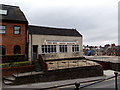
Pope Bros office and yard in Swindon
Building contractors' premises viewed across Cricklade Street looking towards the corner of Church Lane.
Image: © Jaggery
Taken: 14 Apr 2013
0.02 miles
7
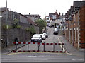
Church Road is closed
The barriers look fairly temporary but the double yellow lines imply a more permanent solution.
Image: © Neil Owen
Taken: 10 Jun 2014
0.02 miles
8
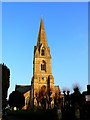
Christ Church, Cricklade Street, Swindon (1)
A view of the Anglican church facing east. It stands on a prominent position in Swindon's Old Town and can be seen from miles around. It was built in 1851 to a design by Sir George Gilbert Scott.
Image: © Brian Robert Marshall
Taken: 6 Feb 2007
0.03 miles
9
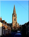
Christ Church, Cricklade Street, Swindon (2)
This view shows the church from a point in Church Road facing east towards Cricklade Street.
Image: © Brian Robert Marshall
Taken: 6 Feb 2007
0.03 miles
10
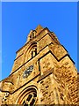
Christ Church, Cricklade Street, Swindon (3)
Looking to the top of the spire.
Image: © Brian Robert Marshall
Taken: 6 Feb 2007
0.03 miles