
IMAGES TAKEN NEAR TO
Mill Lane, CORSHAM, SN13 8PN
Introduction
This page details the photographs taken nearby to Mill Lane, SN13 8PN by members of the Geograph project.
The Geograph project started in 2005 with the aim of publishing, organising and preserving representative images for every square kilometre of Great Britain, Ireland and the Isle of Man.

There are currently over 7.5m images from over14,400 individuals and you can help contribute to the project by visiting https://www.geograph.org.uk
Image Map
Images are licensed for reuse under creativecommons.org/licenses/by-sa/2.0
Notes
- Clicking on the map will re-center to the selected point.
- The higher the marker number, the further away the image location is from the centre of the postcode.
Image Listing (19 Images Found)
Images are licensed for reuse under creativecommons.org/licenses/by-sa/2.0
Image
Details
Distance
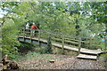
2
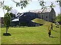
Box Mill Theatre
A brave architect designed this combination of the old mill and a very modern building.
Image: © Graham Horn
Taken: 2 May 2007
0.08 miles
4
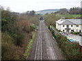
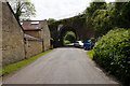
Box (Mill Lane) Halt railway station (site), Wiltshire
Opened in 1930 by the Great Western Railway on its line from Swindon to Bristol Temple Meads, this Halt closed in 1965.
View west from London Road, the halt platforms were beyond the green signal. The original 1841 Box station (see Image) was considered too distant by the villagers, who petitioned the Great Western for many years to get one closer. In the event, the halt lasted just 35 years.
Image: © Nigel Thompson
Taken: 31 Mar 2018
0.11 miles
6
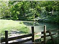
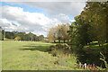
The By Brook
Magnificent riverside scenery north of Bath. The Macmillan Way long distance path follows this river valley for seven miles to Castle Combe.
Image: © Graham Horn
Taken: 2 May 2007
0.13 miles
7
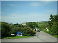
The Wharf, Box
Looking north-northwest from a Bath-bound National Express coach.
Image: © Robert Lamb
Taken: 31 Jul 2011
0.17 miles
8
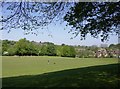
Box playing fields
North of the A4 and south of the railway, is Box's open space. A vast area of playing fields being used on this occasion just by one dog walker. There is as much open space behind the photographer as in this picture.
Image: © Graham Horn
Taken: 2 May 2007
0.18 miles
9
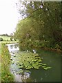
The By Brook
The By Brook flows in a south-easterly direction until it joins the river Avon at Bathford, on the outskirts of Bath. In spite of the dry weather, the brook appeared to be very full.
Image: © Sharon Loxton
Taken: 30 Jul 2006
0.19 miles
10
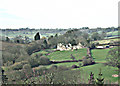
2008 : Slade's Farm, north of Box
On the A4 out of Box we get this view of Slade's Farm. Ingalls Cottages are a little way to the right on the same level. Just visible in the left background is Alcombe Manor with Banner Down behind.
Image: © Maurice Pullin
Taken: 25 Feb 2008
0.19 miles