2008 : Slade's Farm, north of Box
Introduction
The photograph on this page of 2008 : Slade's Farm, north of Box by Maurice Pullin as part of the Geograph project.
The Geograph project started in 2005 with the aim of publishing, organising and preserving representative images for every square kilometre of Great Britain, Ireland and the Isle of Man.

There are currently over 7.5m images from over 14,400 individuals and you can help contribute to the project by visiting https://www.geograph.org.uk
2008 : Slade's Farm, north of Box
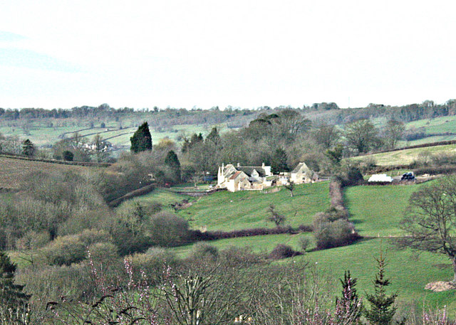
Image: © Maurice Pullin Taken: 25 Feb 2008
On the A4 out of Box we get this view of Slade's Farm. Ingalls Cottages are a little way to the right on the same level. Just visible in the left background is Alcombe Manor with Banner Down behind.
Images are licensed for reuse under creativecommons.org/licenses/by-sa/2.0
Image Location


Leaflet Map data © OpenStreetMap
Latitude
51.421531
Longitude
-2.256229