IMAGES TAKEN NEAR TO
Church Road, CALNE, SN11 9NR
Introduction
This page details the photographs taken nearby to Church Road, SN11 9NR by members of the Geograph project.
The Geograph project started in 2005 with the aim of publishing, organising and preserving representative images for every square kilometre of Great Britain, Ireland and the Isle of Man.

There are currently over 7.5m images from over14,400 individuals and you can help contribute to the project by visiting https://www.geograph.org.uk
Image Map
Images are licensed for reuse under creativecommons.org/licenses/by-sa/2.0
Notes
- Clicking on the map will re-center to the selected point.
- The higher the marker number, the further away the image location is from the centre of the postcode.
Image Listing (47 Images Found)
Images are licensed for reuse under creativecommons.org/licenses/by-sa/2.0
Image
Details
Distance
1
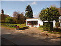
Derry Hill: post office/stores and postbox № SN11 128
An amenity the village is fortunate still to have.
Image: © Chris Downer
Taken: 4 Apr 2009
0.05 miles
2
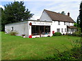
The Village Stores, Derry Hill
There is a small post office counter within the store.
Image: © Maigheach-gheal
Taken: 27 Aug 2010
0.08 miles
3
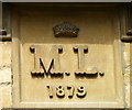
Date stone, Derry Hill
The date stone is to be found on Sunshine Cottage http://www.geograph.org.uk/photo/2041893
Image: © Maigheach-gheal
Taken: 27 Aug 2010
0.10 miles
4
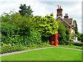
Telephone box, Derry Hill
The K6 type telephone box stands beside Sunshine Cottage.
In 1935, the Post Office commissioned a new kiosk from Sir Giles Gilbert Scott to celebrate the Jubilee of King George V. The K6 Jubilee Kiosk, as it is known, was similar to the K2 box, being made of cast iron and painted red but was 25% lighter in weight. By the end of the 1930s there were 20,000 K6 telephone boxes in use all over the UK.
Image: © Maigheach-gheal
Taken: 27 Aug 2010
0.10 miles
5
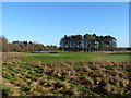
Golf in the park
Seen from the footpath is part of Bowood Park's golf course.
Image: © Michael Dibb
Taken: 6 Dec 2014
0.11 miles
6
![Golf in the park [2]](https://s0.geograph.org.uk/geophotos/04/27/01/4270124_a891c6d6_120x120.jpg)
Golf in the park [2]
Seen from the footpath is part of Bowood Park's golf course including this water hazard complete with resident birds (birds not birdies).
Image: © Michael Dibb
Taken: 6 Dec 2014
0.13 miles
7
![Between the wood and the park [1]](https://s3.geograph.org.uk/geophotos/04/27/01/4270131_c802028f_120x120.jpg)
Between the wood and the park [1]
The footpath runs around the northern perimeter of Bowood Park, alongside Queenswood Plantation.
Image: © Michael Dibb
Taken: 6 Dec 2014
0.14 miles
8
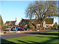
Derry Hill
At the junction of Church Road, Derry Hill, and the A342 Devizes Road is the Golden Gates into Bowood Park Image, the Lansdowne Arms Image, and these delightful Bowood Estate Cottages. Church Road was, until 1810, part of the main London to Bristol Road and travellers would then descend Derry Hill. The cottages dating to circa 1850 are listed, grade II with details at http://list.english-heritage.org.uk/resultsingle.aspx?uid=1253789 and at http://list.english-heritage.org.uk/resultsingle.aspx?uid=1261708
Image: © Michael Dibb
Taken: 6 Dec 2014
0.19 miles
9
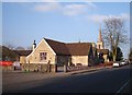
Derry Hill Church of England Primary School
Built in 1872 to replace the existing school which used to be situated opposite the entrance to Bowood Park.
Image: © Janine Forbes
Taken: 18 Mar 2006
0.19 miles