
IMAGES TAKEN NEAR TO
The Drive, BANSTEAD, SM7 1DG
Introduction
This page details the photographs taken nearby to The Drive, SM7 1DG by members of the Geograph project.
The Geograph project started in 2005 with the aim of publishing, organising and preserving representative images for every square kilometre of Great Britain, Ireland and the Isle of Man.

There are currently over 7.5m images from over14,400 individuals and you can help contribute to the project by visiting https://www.geograph.org.uk
Image Map
Images are licensed for reuse under creativecommons.org/licenses/by-sa/2.0
Notes
- Clicking on the map will re-center to the selected point.
- The higher the marker number, the further away the image location is from the centre of the postcode.
Image Listing (23 Images Found)
Images are licensed for reuse under creativecommons.org/licenses/by-sa/2.0
Image
Details
Distance
1
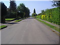
Tumblewood Road
Nork, Banstead. The smart part of Banstead.
Image: © David Howard
Taken: 24 May 2009
0.05 miles
3
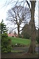
Tumble Beacon
A bronze age bowl barrow, now enclosed in the private garden of the house behind, 'Beacon'. The barrow is on the summit of Banstead Downs, and was formerly used as a beacon. Apparently, the barrow was excavated for use as an air-raid shelter during World War II.
Image: © Hugh Craddock
Taken: 27 Dec 2013
0.08 miles
4
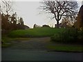
Tumble Beacon
A bronze age bowl barrow, now enclosed in a private garden. The barrow is on the summit of Banstead Downs, and was formerly used as a beacon. Apparently, the barrow was excavated for use as an air-raid shelter during World War II.
Image: © Hugh Craddock
Taken: 23 Apr 2013
0.09 miles
5
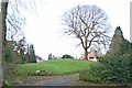
Tumble Beacon
A bronze age bowl barrow, now enclosed in a private garden. The barrow is on the summit of Banstead Downs, and was formerly used as a beacon. Apparently, the barrow was excavated for use as an air-raid shelter during World War II.
Image: © Hugh Craddock
Taken: 27 Dec 2013
0.09 miles
6
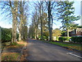
The Drive
Church Lane comes from Reigate Road (A240) and passes between Nork Park and Tattenham Way Recreation Ground as a path before becoming The Drive which is the road seen here. It then reaches Brighton Road (A217) a little way ahead.
Image: © Marathon
Taken: 4 Nov 2013
0.11 miles
7
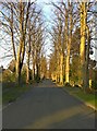
The Drive
The Drive is the former drive to Nork Park from Banstead and the Sutton to Reigate turnpike (now the Brighton Road): hence the fine avenue of trees. This part of the drive was itself laid out on the alignment of Church Lane, which connected Banstead village to Great Burgh, and which remains as public bridleway Banstead 23.
Image: © Hugh Craddock
Taken: 23 Apr 2013
0.12 miles
8
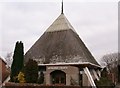
Banstead, Surrey
This unusual building is the Banstead Methodist Church. The majority of this square is taken up with residential housing estates and the main A217 main road.
Image: © Brendan and Ruth McCartney
Taken: 2 Feb 2005
0.12 miles
9
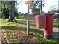
View from The Drive, Banstead
This is close to the junction with Brighton Road (A217) and looks towards the road called Woodgavil.
Image: © Marathon
Taken: 4 Nov 2013
0.15 miles
10
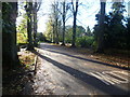
The Drive
The Drive leads from Brighton Road to become Church Lane ahead which is a path passing between Nork Park and Tattenham Way Recreation Ground.
Image: © Marathon
Taken: 4 Nov 2013
0.17 miles