
IMAGES TAKEN NEAR TO
Birchwood Avenue, WALLINGTON, SM6 7EN
Introduction
This page details the photographs taken nearby to Birchwood Avenue, SM6 7EN by members of the Geograph project.
The Geograph project started in 2005 with the aim of publishing, organising and preserving representative images for every square kilometre of Great Britain, Ireland and the Isle of Man.

There are currently over 7.5m images from over14,400 individuals and you can help contribute to the project by visiting https://www.geograph.org.uk
Image Map
Images are licensed for reuse under creativecommons.org/licenses/by-sa/2.0
Notes
- Clicking on the map will re-center to the selected point.
- The higher the marker number, the further away the image location is from the centre of the postcode.
Image Listing (64 Images Found)
Images are licensed for reuse under creativecommons.org/licenses/by-sa/2.0
Image
Details
Distance
2
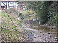
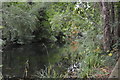
River Wandle alongside Mill Lane
The River Wandle, looking towards Wilderness Island, Mill Lane is to the left.
The river is usually less dry, the winter had an effect on the water table though.
Image: © Thomas Wood
Taken: 18 Mar 2006
0.14 miles
3
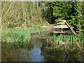
Looking across river to Wilderness Island
The opposite bank was once an artificial island between the two branches of the Wandle, with several large ponds, originally dug as carp ponds. It is now a nature reserve.
Image: © Robin Webster
Taken: 28 Mar 2012
0.14 miles
4
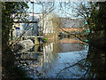
River Wandle above former mill
This is where the river branch from the Carshalton direction joins the branch from the Croydon direction. The former is in the foreground coming in from the right. The combined flow then passes via two routes under the mill site on the left which is now given over to other industry.
Image: © Robin Webster
Taken: 28 Mar 2012
0.16 miles
5
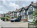
River Gardens
c.1930s housing in a road alongside the River Wandle, first shown on the 1935 25 inch map. Earlier maps show this area to have been the grounds of Shepley House, named after the Shepleys who operated a leather mill on the River Wandle for many years. the last owner, before the house was demolished in the 1930s was a wine merchant Charles Dingwall.
Image: © Ian Capper
Taken: 7 Oct 2022
0.16 miles
8
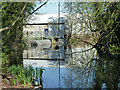
River Wandle above former mill
This is where the river branch from the Carshalton direction joins the branch from the Croydon direction. The former is in the foreground, looking downstream. The other is round to the right. The combined flow then passes via two routes under the mill site ahead which is now given over to other industry. One of the routes passes through the grill and sluice ahead.
Image: © Robin Webster
Taken: 28 Mar 2012
0.17 miles
10
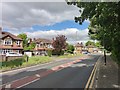
London Road towards Mitcham
A237 main road.
More Info : https://www.sabre-roads.org.uk/wiki/index.php?title=A237
Image: © James Emmans
Taken: 11 May 2020
0.18 miles