
IMAGES TAKEN NEAR TO
Beddington Gardens, WALLINGTON, SM6 0JF
Introduction
This page details the photographs taken nearby to Beddington Gardens, SM6 0JF by members of the Geograph project.
The Geograph project started in 2005 with the aim of publishing, organising and preserving representative images for every square kilometre of Great Britain, Ireland and the Isle of Man.

There are currently over 7.5m images from over14,400 individuals and you can help contribute to the project by visiting https://www.geograph.org.uk
Image Map
Images are licensed for reuse under creativecommons.org/licenses/by-sa/2.0
Notes
- Clicking on the map will re-center to the selected point.
- The higher the marker number, the further away the image location is from the centre of the postcode.
Image Listing (112 Images Found)
Images are licensed for reuse under creativecommons.org/licenses/by-sa/2.0
Image
Details
Distance
1
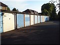
Garages by Embassy Court, Wallington
Looking from the Shotfield entrance. I was surprised at the lack of cars, as the garages are clearly used - presumably by the residents of Embassy Court.
Image: © Rich Tea
Taken: 17 Jun 2008
0.05 miles
2
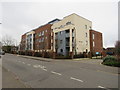
Elles House, Shotfield, Wallington
Elles House is a recently-built apartment block in Wallington, in the outer suburbs of south London.
Image: © Malc McDonald
Taken: 11 Jan 2020
0.07 miles
3
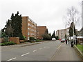
Shotfield, Wallington
Shotfield is a residential road in Wallington, in the outer suburbs of south London.
Image: © Malc McDonald
Taken: 11 Jan 2020
0.08 miles
4

Wallington Methodist Church
The entrance at the corner of Shotfield and Beddington Gardens.
2008 is the church's centenary year.
Image: © Rich Tea
Taken: 17 Jun 2008
0.08 miles
6
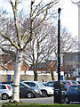
Big Brother is watching us
Someone has stencilled the date 1984 onto the column of these car park CCTV cameras. For context, see Image
Image: © Stephen Craven
Taken: 6 Feb 2015
0.08 miles
7
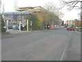
Erection of assisted care living accommodation, Shotfield
The redevelopment of the former Wallington magistrates court is described in Sutton Council’s planning application D2012/66638 as the “erection of part three, part five storey building to provide forty two-bedroomed and fifteen 2-bedroomed assisted living care accommodation and community facilities (Class D1) together with integral refuse, recycling, mobility buggies and cycle area and provision of car parking. new access road and associated landscaping”. The developer is McCarthy and Stone. Thanks for Noel Foster for photographing Image before they disappeared for good.
Image: © John Baker
Taken: 18 Nov 2014
0.08 miles
8

Wallington Methodist Church, Shotfield
Looking across Shotfield from the entrance of Embassy Court
Image: © Rich Tea
Taken: 17 Jun 2008
0.08 miles
9
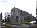
Methodist church, Beddington Gardens, Wallington
This place of worship on the corner of Shotfield was built in 1908, and looks as if it was designed to have a substantial tower. I guess that, as was often the case with church designs, not enough money was raised to complete it and the upper part of the tower was omitted.
Image: © Stephen Craven
Taken: 6 Feb 2015
0.08 miles
10
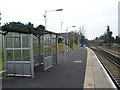
Wallington station
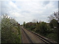
Wallington station opened on 10th May 1847 by the London, Brighton & South Coast Railway on the new Croydon to Epsom railway. Wallington at that time was just a small hamlet around Wallington Green. What is now central Wallington was just fields. The new station, which stood some distance from the hamlet, was called Carshalton as that was the largest nearby place it was built to serve. The population expanded around the new station and when in 1868 Carshalton was finally given its own station on the newly-opened Sutton to Mitcham Junction line, the old Carshalton station became Wallington station.
Image: © Marathon
Taken: 6 Mar 2013
0.08 miles