
IMAGES TAKEN NEAR TO
Talbot Road, CARSHALTON, SM5 3BP
Introduction
This page details the photographs taken nearby to Talbot Road, SM5 3BP by members of the Geograph project.
The Geograph project started in 2005 with the aim of publishing, organising and preserving representative images for every square kilometre of Great Britain, Ireland and the Isle of Man.

There are currently over 7.5m images from over14,400 individuals and you can help contribute to the project by visiting https://www.geograph.org.uk
Image Map
Images are licensed for reuse under creativecommons.org/licenses/by-sa/2.0
Notes
- Clicking on the map will re-center to the selected point.
- The higher the marker number, the further away the image location is from the centre of the postcode.
Image Listing (316 Images Found)
Images are licensed for reuse under creativecommons.org/licenses/by-sa/2.0
Image
Details
Distance
1
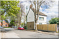
Cator Road
Short road linking Ruskin Road and Talbot Road, first marked on the 1913 25 inch map (where it was named Gator Road, the current name being shown on the 1935 edition). In the centre of the photo is the sewer vent column in Image
Image: © Ian Capper
Taken: 25 Apr 2023
0.06 miles
2
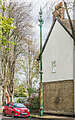
Sewer vent column, Cator Road
Sewer vent column in Cator Road, one of at least 31 such columns in the old Carshalton UDC area (see description below - this is no 7 on the map). This example has the arrow below the globe at the top of the column. Grade II listed - see https://historicengland.org.uk/listing/the-list/list-entry/1468366?section=official-list-entry. For a wider view see Image
Image: © Ian Capper
Taken: 25 Apr 2023
0.06 miles
3

Carshalton Cator Road
With an ornamental sewer vent pipe. Round the corner is Talbot Road, on the left is a cemetery.
Image: © Dr Neil Clifton
Taken: 16 Apr 2012
0.08 miles
4

Carshalton: watercourse
Running from Carshalton Park towards the Wandle, this wide strip of land boasts little dams, control sluices and everything one would need for a string of ornamental pools or watercress beds - except for running water.
Image: © Christopher Hilton
Taken: 30 Mar 2012
0.08 miles

6
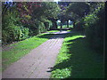
Footpath between Ruskin Road (B271) and Talbot Road, Carshalton.
Image: © Noel Foster
Taken: 31 Aug 2005
0.09 miles

9

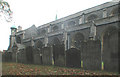
All Saints Churchyard, Carshalton (viii)
Image: © Basher Eyre
Taken: 3 Feb 2018
0.10 miles
10

Guy Fawkes' bonfire, Carshalton Park
Image: © Christopher Hilton
Taken: 5 Nov 2011
0.10 miles