IMAGES TAKEN NEAR TO
The Causeway, CARSHALTON, SM5 2NF
Introduction
This page details the photographs taken nearby to The Causeway, SM5 2NF by members of the Geograph project.
The Geograph project started in 2005 with the aim of publishing, organising and preserving representative images for every square kilometre of Great Britain, Ireland and the Isle of Man.

There are currently over 7.5m images from over14,400 individuals and you can help contribute to the project by visiting https://www.geograph.org.uk
Image Map
Images are licensed for reuse under creativecommons.org/licenses/by-sa/2.0
Notes
- Clicking on the map will re-center to the selected point.
- The higher the marker number, the further away the image location is from the centre of the postcode.
Image Listing (91 Images Found)
Images are licensed for reuse under creativecommons.org/licenses/by-sa/2.0
Image
Details
Distance
2
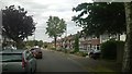
Strawberry Lane
Semi-detached houses in Strawberry Lane, a road partially developed on the 1935 25 inch map, including these.
Image: © Ian Capper
Taken: 25 Apr 2023
0.06 miles
4
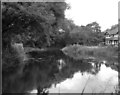
River Wandle at Carshalton
The Wandle has in its time been a heavily industrialised river, and, running through urban areas for much of its course, now retains little of the pristine beauty it had when Shelley walked its banks. But there do remain some pleasant stretches, as here beside River Gardens in Carshalton.
Image: © Dr Neil Clifton
Taken: 21 Jul 1973
0.07 miles
5
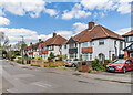
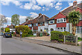
Strawberry Lane
Semi-detached houses in Strawberry Lane, a road partially developed on the 1935 25 inch map, with the ones here being slightly later, first being marked in outline on the 1944 6 inch map.
Image: © Ian Capper
Taken: 25 Apr 2023
0.08 miles
6
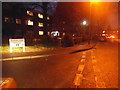
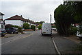
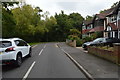
Strawberry Lane at the junction of Devana End
Image: © David Howard
Taken: 12 Jan 2014
0.08 miles
9
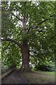
River Gardens
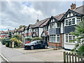
c.1930s housing in a road alongside the River Wandle, first shown on the 1935 25 inch map. Earlier maps show this area to have been the grounds of Shepley House, named after the Shepleys who operated a leather mill on the River Wandle for many years. the last owner, before the house was demolished in the 1930s was a wine merchant Charles Dingwall.
Image: © Ian Capper
Taken: 7 Oct 2022
0.08 miles