
IMAGES TAKEN NEAR TO
Cooper Crescent, CARSHALTON, SM5 2DL
Introduction
This page details the photographs taken nearby to Cooper Crescent, SM5 2DL by members of the Geograph project.
The Geograph project started in 2005 with the aim of publishing, organising and preserving representative images for every square kilometre of Great Britain, Ireland and the Isle of Man.

There are currently over 7.5m images from over14,400 individuals and you can help contribute to the project by visiting https://www.geograph.org.uk
Image Map
Images are licensed for reuse under creativecommons.org/licenses/by-sa/2.0
Notes
- Clicking on the map will re-center to the selected point.
- The higher the marker number, the further away the image location is from the centre of the postcode.
Image Listing (55 Images Found)
Images are licensed for reuse under creativecommons.org/licenses/by-sa/2.0
Image
Details
Distance
1
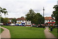
Shopping parade opposite Wrythe Green, Carshalton
Another suburban shopping parade where some of the shops have closed. Note the handsome ornamental sewer vent on the Green. There are a number of these around Carshalton. The bus is on Route 151 from Worcester Park station to Wallington.
Image: © Dr Neil Clifton
Taken: 5 Jul 2007
0.05 miles
2
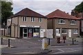
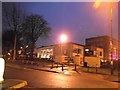
Liberal Democrat HQ for Carshalton and Wallington
Tom Brake was elected at the 1997 General Election.
Image: © Peter Trimming
Taken: 23 Jul 2018
0.06 miles
3
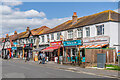
Green Wrythe Lane shopping parade
Row of shops on Green Wrythe Lane opposite Wrythe Green, built in the c.1930s. The site was previously that of a workhouse built in 1792 and later named Leicester House (as shown on the 1898 25 inch map), and used for a time as a convalescent asylum and then as a succession of education establishments, with the building being named as Carshalton College on the 1913 25 inch map.
Image: © Ian Capper
Taken: 25 Apr 2023
0.07 miles
4
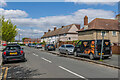
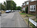
Culvers Way
Housing estate first marked on the 1935 25 inch map.
Image: © Ian Capper
Taken: 25 Apr 2023
0.08 miles
5
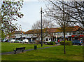
Carshalton: Wrythe Green
One of the ornamental sewer vent pipes is seen in the centre: this pipe, originally green, has been repainted in black with a golden crown.
For a picture taken from the same place some 29 years earlier, seeImage
Image: © Dr Neil Clifton
Taken: 14 Apr 2012
0.08 miles
8
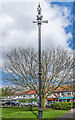
Sewer vent column, Wrythe Green
Sewer vent column on Wrythe Green, one of at least 31 such columns in the old Carshalton UDC area (see description below - this is no 29 on the map). This example has the arrow below the globe at the top of the column. Grade II listed - see https://historicengland.org.uk/listing/the-list/list-entry/1469056?section=official-list-entry. For wider views see Image and Image
Image: © Ian Capper
Taken: 25 Apr 2023
0.09 miles
9
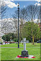
War memorial, Wrythe Green
War memorial on Wrythe Green, unveiled on 15 July 2017, commemorating the 45 men from The Wrythe who fell in the First World War. It complements a wooden cross in All Saints' Churchyard which had originally stood at St Andrew's Church, Wrythe Lane, with the cross being moved when the church was demolished in 1964. In the background is the sewer vent column in Image
Image: © Ian Capper
Taken: 25 Apr 2023
0.09 miles
10
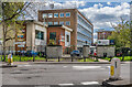
Carshalton College
Further education college on Nightingale Road.
Image: © Ian Capper
Taken: 25 Apr 2023
0.09 miles