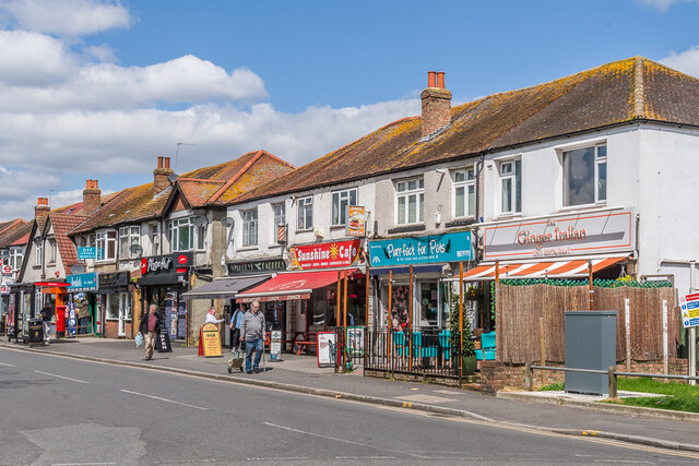
Green Wrythe Lane shopping parade
Introduction
The photograph on this page of Green Wrythe Lane shopping parade by Ian Capper as part of the Geograph project.
The Geograph project started in 2005 with the aim of publishing, organising and preserving representative images for every square kilometre of Great Britain, Ireland and the Isle of Man.
There are currently over 7.5m images from over 14,400 individuals and you can help contribute to the project by visiting https://www.geograph.org.uk

Image: © Ian Capper Taken: 25 Apr 2023
Row of shops on Green Wrythe Lane opposite Wrythe Green, built in the c.1930s. The site was previously that of a workhouse built in 1792 and later named Leicester House (as shown on the 1898 25 inch map), and used for a time as a convalescent asylum and then as a succession of education establishments, with the building being named as Carshalton College on the 1913 25 inch map.

