IMAGES TAKEN NEAR TO
Kimpton Park Way, SUTTON, SM3 9BW
Introduction
This page details the photographs taken nearby to Kimpton Park Way, SM3 9BW by members of the Geograph project.
The Geograph project started in 2005 with the aim of publishing, organising and preserving representative images for every square kilometre of Great Britain, Ireland and the Isle of Man.

There are currently over 7.5m images from over14,400 individuals and you can help contribute to the project by visiting https://www.geograph.org.uk
Image Map
Images are licensed for reuse under creativecommons.org/licenses/by-sa/2.0
Notes
- Clicking on the map will re-center to the selected point.
- The higher the marker number, the further away the image location is from the centre of the postcode.
Image Listing (25 Images Found)
Images are licensed for reuse under creativecommons.org/licenses/by-sa/2.0
Image
Details
Distance
1
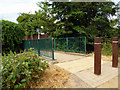
North Cheam: footbridge over Pyl Brook
This brook is a tributary of Beverley Brook, which in turn flows into the Thames.
Image: © Dr Neil Clifton
Taken: 26 Jul 2013
0.04 miles
2
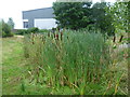
Kimpton Balancing Pond
The Pyl Brook is a tributary of the Beverley Brook which in turn feeds into the River Thames upriver of Putney. The Pyl Brook runs underground for part of its course upstream before emerging above the ground in Hamilton Avenue Recreation Ground west of Kimpton Road.
At the time of the 1866 Ordnance Survey Map, this part of the Pyl Brook was surrounded by small fields, bordered by trees and hedges. The rural outlook changed within 30 years as the 1896 Ordnance Survey Map showed a gas holder, a sewage works and a cemetery to the north.
Some 20 years ago there was just a footpath alongside the Pyl Brook and a strip of wildlife habitat between Kimpton Road and the A24 at London Road. Recently Hamilton Avenue Recreation Ground has been created and added to Kimpton Open Space which runs as far as the A24.
Kimpton Balancing Pond seen here which is within Kimpton Open Space was primarily created for the management of flood risk. Its purpose is to hold surface water run-off from the adjacent industrial units at times of heavy rain. One of these units is seen beyond. The filtered rain then flows through the pond and out of the drainage pipes in a more regulated fashion. A bonus is that a number of wetland plants have found a home here.
Image: © Marathon
Taken: 11 Sep 2013
0.06 miles
3
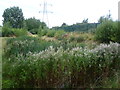
Kimpton Balancing Pond
The Pyl Brook is a tributary of the Beverley Brook which in turn feeds into the River Thames upriver of Putney. The Pyl Brook runs underground for part of its course upstream before emerging above the ground in Hamilton Avenue Recreation Ground west of Kimpton Road.
At the time of the 1866 Ordnance Survey Map, this part of the Pyl Brook was surrounded by small fields, bordered by trees and hedges. The rural outlook changed within 30 years as the 1896 Ordnance Survey Map showed a gas holder, a sewage works and a cemetery to the north.
Some 20 years ago there was just a footpath alongside the Pyl Brook and a strip of wildlife habitat between Kimpton Road and the A24 at London Road. Recently Hamilton Avenue Recreation Ground has been created and added to Kimpton Open Space which runs as far as the A24.
Kimpton Balancing Pond seen here which is within Kimpton Open Space was primarily created for the management of flood risk. Its purpose is to hold surface water run-off from the adjacent industrial units at times of heavy rain. The filtered rain then flows through the pond and out of the drainage pipes in a more regulated fashion. A bonus is that a number of wetland plants have found a home here.
Image: © Marathon
Taken: 11 Sep 2013
0.07 miles
5
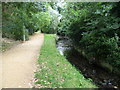
Footpath alongside the Pyl Brook in Kimpton Open Space
The Pyl Brook is a tributary of the Beverley Brook which in turn feeds into the River Thames upriver of Putney. The Pyl Brook runs underground for part of its course upstream before emerging above the ground in Hamilton Avenue Recreation Ground west of Kimpton Road.
At the time of the 1866 Ordnance Survey Map, this part of the Pyl Brook was surrounded by small fields, bordered by trees and hedges. The rural outlook changed within 30 years as the 1896 Ordnance Survey Map showed a gas holder, a sewage works and a cemetery to the north.
Some 20 years ago there was just a footpath alongside the Pyl Brook and a strip of wildlife habitat between Kimpton Road and the A24 at London Road. Recently Hamilton Avenue Recreation Ground has been created and added to Kimpton Open Space which runs as far as the A24. In May 2011 the revitalised Pyl Brook was re-opened after major works were carried out to re-route and re-landscape this section of the brook and create a meander just upstream of here.
This view of the Pyl Brook looks upstream with the route of the original footpath on the left and back gardens of houses in Hamilton Avenue beyond the trees on the right.
Image: © Marathon
Taken: 11 Sep 2013
0.12 miles
6
Brocks Drive at the junction of Gander Green Lane
Image: © David Howard
Taken: 15 Jun 2014
0.17 miles
7
North Cheam: Ridge Road
Looking east from its junction with Stonecot Hill
Image: © Dr Neil Clifton
Taken: 26 Jul 2013
0.17 miles
8
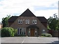
North Cheam Baptist Church
This Baptist Church has stood here since about the 1920s, originally the site had an old Tin hut for the church. This part of the building was due to be the halls with the car park being the intended site for the sanctuary. The plot, first built was surrounded by fields, it is now a densely populated residential area. The Church is very active in the community, many of its back halls being used for midweek groups.
Image: © Dave Eadie
Taken: 7 Aug 2005
0.18 miles
9
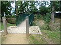
Footbridge over the Pyl Brook
The Pyl Brook is a tributary of the Beverley Brook which in turn feeds into the River Thames upriver of Putney. The Pyl Brook runs underground for part of its course upstream before emerging above the ground in Hamilton Avenue Recreation Ground west of Kimpton Road.
At the time of the 1866 Ordnance Survey Map, this part of the Pyl Brook was surrounded by small fields, bordered by trees and hedges. The rural outlook changed within 30 years as the 1896 Ordnance Survey Map showed a gas holder, a sewage works and a cemetery to the north.
Some 20 years ago there was just a footpath alongside the Pyl Brook and a strip of wildlife habitat between Kimpton Road and the A24 at London Road. Recently Hamilton Avenue Recreation Ground has been created and added to Kimpton Open Space which runs as far as the A24. In May 2011 the revitalised Pyl Brook was re-opened after major works were carried out to re-route and re-landscape this section of the brook and create a meander just upstream of here. This bridge over the Pyl Brook is on the western edge of Hamilton Avenue Recreation Ground.
Image: © Marathon
Taken: 11 Sep 2013
0.18 miles