North Cheam Baptist Church
Introduction
The photograph on this page of North Cheam Baptist Church by Dave Eadie as part of the Geograph project.
The Geograph project started in 2005 with the aim of publishing, organising and preserving representative images for every square kilometre of Great Britain, Ireland and the Isle of Man.

There are currently over 7.5m images from over 14,400 individuals and you can help contribute to the project by visiting https://www.geograph.org.uk
North Cheam Baptist Church
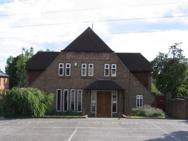
Image: © Dave Eadie Taken: 7 Aug 2005
This Baptist Church has stood here since about the 1920s, originally the site had an old Tin hut for the church. This part of the building was due to be the halls with the car park being the intended site for the sanctuary. The plot, first built was surrounded by fields, it is now a densely populated residential area. The Church is very active in the community, many of its back halls being used for midweek groups.
Images are licensed for reuse under creativecommons.org/licenses/by-sa/2.0
Image Location
Latitude
51.380372
Longitude
-0.216748