IMAGES TAKEN NEAR TO
Golf Side, SUTTON, SM2 7HA
Introduction
This page details the photographs taken nearby to Golf Side, SM2 7HA by members of the Geograph project.
The Geograph project started in 2005 with the aim of publishing, organising and preserving representative images for every square kilometre of Great Britain, Ireland and the Isle of Man.

There are currently over 7.5m images from over14,400 individuals and you can help contribute to the project by visiting https://www.geograph.org.uk
Image Map
Images are licensed for reuse under creativecommons.org/licenses/by-sa/2.0
Notes
- Clicking on the map will re-center to the selected point.
- The higher the marker number, the further away the image location is from the centre of the postcode.
Image Listing (14 Images Found)
Images are licensed for reuse under creativecommons.org/licenses/by-sa/2.0
Image
Details
Distance
1
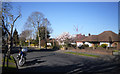
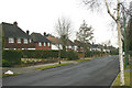
Sandy Lane
Between Nonsuch Park and Banstead Downs the London Loop Path has to go roadside for about 2km as there are no linking footpaths.
But the streets are quiet residential ones like Sandy Lane here, and on a day like this with all the spring stuff coming out it's pleasant enough.
Image: © Des Blenkinsopp
Taken: 26 Mar 2012
0.09 miles
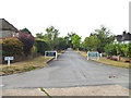
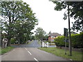
2
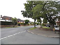
High View at the junction of Sandy Lane, Belmont
Image: © David Howard
Taken: 1 Jun 2014
0.09 miles
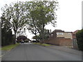
5
Sandy Lane, Sutton
The housing development hereabouts dates from a decade or so after World War II.
Image: © David Kemp
Taken: 14 Feb 2009
0.15 miles
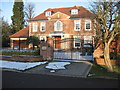
6
Belmont: Golf Side
From Cuddington Way
Image: © Dr Neil Clifton
Taken: 27 Jul 2013
0.18 miles
7
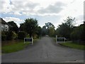
Golf Side private road, Cheam
This secluded street is a privately owned road which skirts Cuddington Golf Course, hence its name.
Image: © Hywel Williams
Taken: 19 Sep 2005
0.19 miles
8

The London LOOP along Sandy Lane
The London LOOP here follows Sandy Lane on its way from Banstead Downs to Nonsuch Park. This is a very exclusive area. After about half a mile it turns left along Cuddington Way - see http://www.geograph.org.uk/photo/3934867
Image: © Marathon
Taken: 16 Apr 2014
0.21 miles
9
Cheyham Way
Another of the suburban roads on the London Loop path making up the roadside section between Nonsuch Park and Banstead Downs.
Image: © Des Blenkinsopp
Taken: 26 Mar 2012
0.23 miles
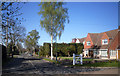
10
Cuddington Way at the junction of Sandy Lane
Image: © David Howard
Taken: 1 Jun 2014
0.24 miles