
IMAGES TAKEN NEAR TO
Beresford Road, SUTTON, SM2 6EW
Introduction
This page details the photographs taken nearby to Beresford Road, SM2 6EW by members of the Geograph project.
The Geograph project started in 2005 with the aim of publishing, organising and preserving representative images for every square kilometre of Great Britain, Ireland and the Isle of Man.

There are currently over 7.5m images from over14,400 individuals and you can help contribute to the project by visiting https://www.geograph.org.uk
Image Map
Images are licensed for reuse under creativecommons.org/licenses/by-sa/2.0
Notes
- Clicking on the map will re-center to the selected point.
- The higher the marker number, the further away the image location is from the centre of the postcode.
Image Listing (4 Images Found)
Images are licensed for reuse under creativecommons.org/licenses/by-sa/2.0
Image
Details
Distance
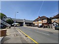
2
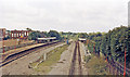
Cheam station, 1986
View westward from the A217 bridge, towards Epsom, Leatherhead, Dorking etc.: ex-LB&SCR Victoria/London Bridge - West Croydon - Sutton - Epsom and the South Coast via Horsham. Evidently at one time there were Down and Up Fast lines through here.
Image: © Ben Brooksbank
Taken: 7 Sep 1986
0.21 miles
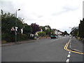
4
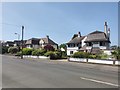
York Road - Belmont
Two houses were originally the same design but one has removed the large chimneys leaving a small modern boiler chimney. The purists would have kept the old chimneys.
Image: © James Emmans
Taken: 9 May 2020
0.22 miles