Cheam station, 1986
Introduction
The photograph on this page of Cheam station, 1986 by Ben Brooksbank as part of the Geograph project.
The Geograph project started in 2005 with the aim of publishing, organising and preserving representative images for every square kilometre of Great Britain, Ireland and the Isle of Man.

There are currently over 7.5m images from over 14,400 individuals and you can help contribute to the project by visiting https://www.geograph.org.uk
Cheam station, 1986
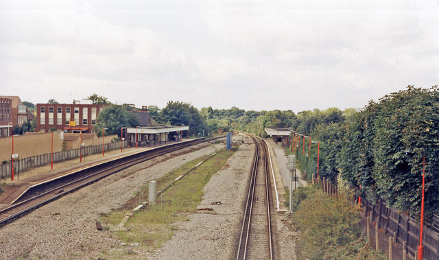
Image: © Ben Brooksbank Taken: 7 Sep 1986
View westward from the A217 bridge, towards Epsom, Leatherhead, Dorking etc.: ex-LB&SCR Victoria/London Bridge - West Croydon - Sutton - Epsom and the South Coast via Horsham. Evidently at one time there were Down and Up Fast lines through here.
Images are licensed for reuse under creativecommons.org/licenses/by-sa/2.0
Image Location
Latitude
51.355756
Longitude
-0.21239