IMAGES TAKEN NEAR TO
Powney Road, MAIDENHEAD, SL6 6EE
Introduction
This page details the photographs taken nearby to Powney Road, SL6 6EE by members of the Geograph project.
The Geograph project started in 2005 with the aim of publishing, organising and preserving representative images for every square kilometre of Great Britain, Ireland and the Isle of Man.

There are currently over 7.5m images from over14,400 individuals and you can help contribute to the project by visiting https://www.geograph.org.uk
Image Map
Images are licensed for reuse under creativecommons.org/licenses/by-sa/2.0
Notes
- Clicking on the map will re-center to the selected point.
- The higher the marker number, the further away the image location is from the centre of the postcode.
Image Listing (34 Images Found)
Images are licensed for reuse under creativecommons.org/licenses/by-sa/2.0
Image
Details
Distance
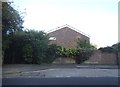
1
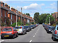
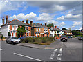
Powney Road, Maidenhead
A road of Victorian or Edwardian semi-detached houses. This view is from the crossroads with Penyston Road and looking towards St Mark's Road.
Image: © Andrew Smith
Taken: 22 Aug 2009
0.12 miles
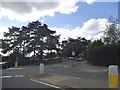
2
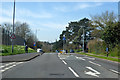
A4 Bath Road, Maidenhead
Heading west out of town.
Image: © Robin Webster
Taken: 22 Mar 2020
0.12 miles
3
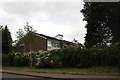
Rear of houses on Boyn Hill Close, Maidenhead
From Bath Road. There is another row of the same houses next to them on the left.
Image: © David Howard
Taken: 8 Jul 2019
0.12 miles
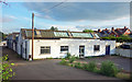
5
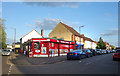
Tesco Express on Bath Road
This was converted from a garage in about 2013
Image: © David Howard
Taken: 9 Aug 2015
0.13 miles
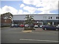
7
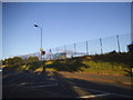
Empty Premises, St Mark's Road
A vacant industrial site waiting for something to happen.
Image: © Des Blenkinsopp
Taken: 10 May 2018
0.13 miles
9
Rutland Road and Rutland Place, Maidenhead
Rutland Place is the road going off to the left. This is part of the pleasant residential area to the west of All Saints' church.
Image: © Andrew Smith
Taken: 22 Aug 2009
0.17 miles
10
Maidenhead Food & Wine
With Ali's fish and chips next door. Local shops at the junction of St Marks and Powney Roads.
Image: © Des Blenkinsopp
Taken: 10 May 2018
0.18 miles