IMAGES TAKEN NEAR TO
Drift Road, MAIDENHEAD, SL6 3SU
Introduction
This page details the photographs taken nearby to Drift Road, SL6 3SU by members of the Geograph project.
The Geograph project started in 2005 with the aim of publishing, organising and preserving representative images for every square kilometre of Great Britain, Ireland and the Isle of Man.

There are currently over 7.5m images from over14,400 individuals and you can help contribute to the project by visiting https://www.geograph.org.uk
Image Map
Images are licensed for reuse under creativecommons.org/licenses/by-sa/2.0
Notes
- Clicking on the map will re-center to the selected point.
- The higher the marker number, the further away the image location is from the centre of the postcode.
Image Listing (11 Images Found)
Images are licensed for reuse under creativecommons.org/licenses/by-sa/2.0
Image
Details
Distance
1
The site of Pickins Farm
Some sort of quarrying goes on here.
Image: © Andrew Smith
Taken: 13 Nov 2005
0.05 miles
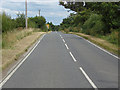
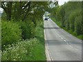
2
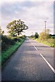
The Drift Road
Looking west along the very straight road.
Image: © Andrew Smith
Taken: 13 Nov 2005
0.09 miles
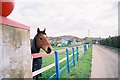
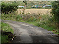
3
Farm access road
The access road the Bourne brook Farm from the Drift Road.
Image: © Alan Hunt
Taken: 27 Jul 2014
0.10 miles
4
Drift Road
Looking east along the Drift Road from the access road to Bourne Brook Farm.
Image: © Alan Hunt
Taken: 27 Jul 2014
0.12 miles
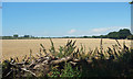
5
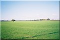
Flat east Berkshire farmland
Just off the Drift Road
Image: © Andrew Smith
Taken: 13 Nov 2005
0.12 miles
6
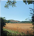
Towards the Odd Hill
Looking almost natural, with trees starting to cover it, this large mound rises suddenly in the midst of flat farmland.
In other parts of the country it could be mine waste or something, but not in Berkshire. I'm not sure what it is or why it's here.
It's at a place called Pickins Farm on the map, but the notice by the approach road calls it Trump Farm.
Needless to say, that complicates a web search. (written in 2020)
Fortunately, it's in the square to the south, so for now this is just another picture of farmland.
Image: © Des Blenkinsopp
Taken: 7 Aug 2020
0.17 miles
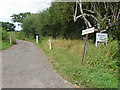
7
Bridleway, off the Drift Road
The access road for Blackbird Cottage and Patterdale Farm.
Image: © Andrew Smith
Taken: 13 Nov 2005
0.18 miles
8
Farm access road
The farm access road running north from the Drift Road which runs just in front of the lorries in the background.
Image: © Alan Hunt
Taken: 27 Jul 2014
0.18 miles
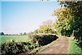
9
The Drift Road, Braywoodside
A long straight on the old drovers' road as it heads west towards the Walthams.
Image: © Andrew Smith
Taken: 5 May 2008
0.21 miles