IMAGES TAKEN NEAR TO
Rowley Lane, SLOUGH, SL3 6PB
Introduction
This page details the photographs taken nearby to Rowley Lane, SL3 6PB by members of the Geograph project.
The Geograph project started in 2005 with the aim of publishing, organising and preserving representative images for every square kilometre of Great Britain, Ireland and the Isle of Man.

There are currently over 7.5m images from over14,400 individuals and you can help contribute to the project by visiting https://www.geograph.org.uk
Image Map
Images are licensed for reuse under creativecommons.org/licenses/by-sa/2.0
Notes
- Clicking on the map will re-center to the selected point.
- The higher the marker number, the further away the image location is from the centre of the postcode.
Image Listing (21 Images Found)
Images are licensed for reuse under creativecommons.org/licenses/by-sa/2.0
Image
Details
Distance
1
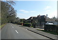
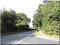
Rowley Lane
The western end of Rowley Lane has a number of individual houses and bungalows. Further east it becomes rural and wooded.
Image: © Graham Horn
Taken: 23 Feb 2012
0.04 miles
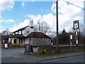
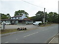
2
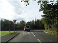
Rowley Lane at the junction of Framewood Road
Image: © David Howard
Taken: 4 Oct 2012
0.08 miles
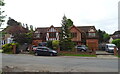
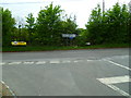
4
Framewood Road at the junction of Rowley Lane
Image: © David Howard
Taken: 4 Oct 2012
0.10 miles
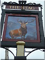
9
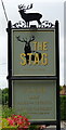
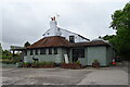
Sign for the Stag, Wexham Street
See Image] for public house.
Image: © JThomas
Taken: 26 May 2022
0.12 miles