IMAGES TAKEN NEAR TO
Anslow Gardens, IVER, SL0 0BW
Introduction
This page details the photographs taken nearby to Anslow Gardens, SL0 0BW by members of the Geograph project.
The Geograph project started in 2005 with the aim of publishing, organising and preserving representative images for every square kilometre of Great Britain, Ireland and the Isle of Man.

There are currently over 7.5m images from over14,400 individuals and you can help contribute to the project by visiting https://www.geograph.org.uk
Image Map
Images are licensed for reuse under creativecommons.org/licenses/by-sa/2.0
Notes
- Clicking on the map will re-center to the selected point.
- The higher the marker number, the further away the image location is from the centre of the postcode.
Image Listing (30 Images Found)
Images are licensed for reuse under creativecommons.org/licenses/by-sa/2.0
Image
Details
Distance
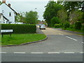
2
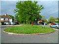
Trewarden Avenue, Iver Heath
Trewarden Avenue is a relatively recent housing development in the village of Iver Heath, Buckinghamshire.
Image: © Malc McDonald
Taken: 2 Jun 2013
0.09 miles
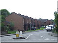
3
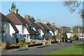
Anslow Gardens, Iver Heath
Anslow Gardens is a residential road in the village of Iver Heath.
Image: © Malc McDonald
Taken: 2 Jun 2013
0.10 miles
4
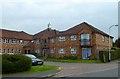
Bodley House with clock tower
This is on Trewarden Avenue. Another view of the clock tower is at Image
Image: © Shazz
Taken: 21 May 2013
0.12 miles
5
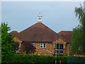
The clock tower on Bodley House
This is seen from Glaisyer Way. For another view see Image
Image: © Shazz
Taken: 21 May 2013
0.12 miles
6
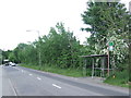
Bangors Road North, Iver Heath
On the opposite side of the road is a bus stop with an old type of shelter.
Image: © Malc McDonald
Taken: 2 Jun 2013
0.15 miles
7
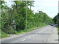
Bangors Road North, Iver Heath
To the left is a bus stop with an old type of shelter.
Image: © Malc McDonald
Taken: 2 Jun 2013
0.15 miles
8
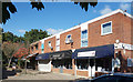
Four Shops, Iver Heath
Italian Restaurant, bridal wear, nail bar and boutique just off Church Road.
Image: © Des Blenkinsopp
Taken: 5 Oct 2017
0.17 miles
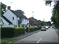
9
Church Road, Iver Heath
These 1950s houses are built on a service road back from the main road, which is to my right. Thus they are isolated somewhat from the constant traffic along that road.
Image: © Graham Horn
Taken: 23 Feb 2012
0.17 miles
10
Looking north on the path from The Parkway
The path is parallel with Church Road.
Image: © Shazz
Taken: 21 May 2013
0.18 miles