1
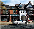
Cedrics Chemist in Alderley Edge
Pharmacy at 67 London Road.
Image: © Jaggery
Taken: 8 Sep 2014
0.04 miles
2
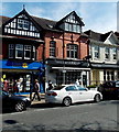
Taste at Corks Out, Alderley Edge
With a depiction of a corkscrew for its first and last letter, Taste at Corks Out is an independent
wine & spirits bar in London Road. A Marie Curie Cancer Care charity shop is on the left.
Image: © Jaggery
Taken: 8 Sep 2014
0.04 miles
3
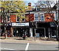
North West Air Ambulance Charity Shop in Alderley Edge
The London Road shop sells donated second-hand clothing and bric-a-brac to raise funds for the
life-saving service provided by North West Air Ambulance. Their helicopters are on duty every day
of the year, with onboard doctors and paramedics providing rapid treatment and hospital transfers,
giving what may be literally vital time to patients across the entire North West of England region.
Image: © Jaggery
Taken: 8 Sep 2014
0.04 miles
4
Alderley Edge Sports & Social Club
Formerly Alderley Edge Union Club, located in Stevens Street, Alderley Edge.
Image: © Jaggery
Taken: 8 Sep 2014
0.04 miles
5
London Road (B5087), Alderley Edge
Alderley Edge is an attractive village about 15 miles south of Manchester. On some older OS maps, London Road is marked as the A34 but has now been renamed the B5087 after the A34 bypass was officially opened on Friday 19th November 2010.
Image: © G Laird
Taken: 6 Aug 2018
0.04 miles
6
Rainbow Balloons showroom and van in Alderley Edge
A Rainbow Balloons van is parked outside the business's showroom in the Union Building, Stevens Street. Dating from 1896, the building has had a number of uses, including as the first cinema in Alderley Edge. As well as balloons for all occasions and events, soft toys, novelty gifts, table confetti, handmade cards, and party goods are on sale here.
Image: © Jaggery
Taken: 8 Sep 2014
0.04 miles
7
What double yellow lines?
Apparent lack of traffic wardens on London Road as several cars are parked on the double yellow lines.
Image: © Ian Paterson
Taken: 1 May 2013
0.04 miles
8
London Road, Alderley Edge
Image: © Anthony Parkes
Taken: 21 Aug 2016
0.05 miles
9
Alderley Edge
Looking north along the London Road (A34).
Image: © Trevor Harris
Taken: 14 Aug 2010
0.05 miles
10
London Road, Alderley Edge
London Road, Alderley Edge's main shopping street, was previously a stretch of the A34, but has been down-graded to the B5087. The town (often referred to as a village) is very much a part of the Cheshire stockbroker belt and has a decidedly affluent feel - there are plenty of upmarket coffee shops and other eateries; even Barclay's Bank (visible in this shot) is still operational. Until 1880 Alderley Edge was known as Chorley but was re-named to avoid confusion with Chorley in Lancashire.
Image: © Stephen McKay
Taken: 7 Jun 2018
0.05 miles


