
London Road, Alderley Edge
Introduction
The photograph on this page of London Road, Alderley Edge by Stephen McKay as part of the Geograph project.
The Geograph project started in 2005 with the aim of publishing, organising and preserving representative images for every square kilometre of Great Britain, Ireland and the Isle of Man.

There are currently over 7.5m images from over 14,400 individuals and you can help contribute to the project by visiting https://www.geograph.org.uk
London Road, Alderley Edge
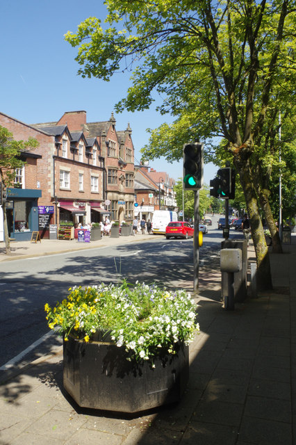
Image: © Stephen McKay Taken: 7 Jun 2018
London Road, Alderley Edge's main shopping street, was previously a stretch of the A34, but has been down-graded to the B5087. The town (often referred to as a village) is very much a part of the Cheshire stockbroker belt and has a decidedly affluent feel - there are plenty of upmarket coffee shops and other eateries; even Barclay's Bank (visible in this shot) is still operational. Until 1880 Alderley Edge was known as Chorley but was re-named to avoid confusion with Chorley in Lancashire.
Images are licensed for reuse under creativecommons.org/licenses/by-sa/2.0
Image Location

Latitude
53.301505
Longitude
-2.236291