IMAGES TAKEN NEAR TO
Beaufort Road, HYDE, SK14 3QS

Introduction

This page details the photographs taken nearby to Beaufort Road, SK14 3QS by members of the Geograph project.

The Geograph project started in 2005 with the aim of publishing, organising and preserving representative images for every square kilometre of Great Britain, Ireland and the Isle of Man.

There are currently over 7.5m images from over14,400 individuals and you can help contribute to the project by visiting https://www.geograph.org.uk

Image Map


Images are licensed for reuse under creativecommons.org/licenses/by-sa/2.0
Notes
  • Clicking on the map will re-center to the selected point.
  • The higher the marker number, the further away the image location is from the centre of the postcode.

Image Listing (50 Images Found)

Images are licensed for reuse under creativecommons.org/licenses/by-sa/2.0
  • ...
Image
Details
Distance
1
Tameside Court, Hattersley
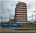
Tameside Court tower block due to be demolished in the next twelve month's, according to a local resident.
Image: © John Topping Taken: 24 Oct 2013
0.07 miles
2
Fields Farm Road, Hattersley
At the junction with Hattersley Road East.
Image: © John Topping Taken: 24 Oct 2013
0.07 miles
3
Hattersley Community Centre
Off Hattersley Road East.
Image: © Gerald England Taken: 16 May 2011
0.07 miles
4
Hattersley Library
In Community Square off Hattersley Road East.
Image: © Gerald England Taken: 16 May 2011
0.07 miles
5
New Apartments
Apartments under construction as part of the ongoing successful regeneration of the Hattersley district, the regeneration started around the year 2000 and there is still several years remaining until its completion.
Image: © Stephen Burton Taken: 28 Jan 2016
0.07 miles
6
The last days of Tameside Court
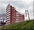
Tameside Court Image was the last of the tower blocks on the Hattersley estate to be built in the 1970s. The other seven built in the mid sixties were demolished in 2001. Now this too is being demolished.
Image: © Gerald England Taken: 30 Mar 2017
0.07 miles
7
The end for Tameside Court
Tameside Court Image was the last of the tower blocks on the Hattersley estate to be built in the 1970s. The other seven built in the mid sixties were demolished in 2001. Now this too is being demolished.
Image: © Gerald England Taken: 30 Mar 2017
0.07 miles
8
Hattersley Road East
This used to be the centre of Hattersley with a library Image, a community centre Image, shops and a pub Image The library is now part of a new community hub Image which has been built next to the Tesco store. The old precinct was demolished in 2013 Image Now the adjacent Tameside Court Image which was the last of the tower blocks on the Hattersley estate to be built in the 1970s is finally being demolished. On the right is a High Peak bus on the #341 route from Glossop to Hyde via Gamesley, Charlesworth, Broadbottom and Backbower.
Image: © Gerald England Taken: 30 Mar 2017
0.07 miles
9
Houses on Hattersley Estate
Image: © Anthony Parkes Taken: 19 Jul 2010
0.08 miles
10
Hattersley multi-storey flats demolition
This tower block is the last building to be demolished in the area that was Hattersley Precinct. When completed in the late 1960s/early 1970s the Four in Hand public house stood to the right of the tower, the red machine stands on the walkway that originally had shops on both sides and the ends, about 25 shops in total selling all sorts of goods even a record shop. Most of the shops were demolished 25/30 years ago the rest following more recently. Close up http://www.geograph.org.uk/photo/5323126
Image: © Stephen Burton Taken: 24 Mar 2017
0.08 miles
  • ...