Hattersley multi-storey flats demolition
Introduction
The photograph on this page of Hattersley multi-storey flats demolition by Stephen Burton as part of the Geograph project.
The Geograph project started in 2005 with the aim of publishing, organising and preserving representative images for every square kilometre of Great Britain, Ireland and the Isle of Man.

There are currently over 7.5m images from over 14,400 individuals and you can help contribute to the project by visiting https://www.geograph.org.uk
Hattersley multi-storey flats demolition
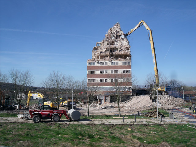
Image: © Stephen Burton Taken: 24 Mar 2017
This tower block is the last building to be demolished in the area that was Hattersley Precinct. When completed in the late 1960s/early 1970s the Four in Hand public house stood to the right of the tower, the red machine stands on the walkway that originally had shops on both sides and the ends, about 25 shops in total selling all sorts of goods even a record shop. Most of the shops were demolished 25/30 years ago the rest following more recently. Close up http://www.geograph.org.uk/photo/5323126
Images are licensed for reuse under creativecommons.org/licenses/by-sa/2.0
Image Location
Latitude
53.44897
Longitude
-2.027516