IMAGES TAKEN NEAR TO
St. Pauls Street, STOCKPORT, SK1 2LE

Introduction

This page details the photographs taken nearby to St. Pauls Street, SK1 2LE by members of the Geograph project.

The Geograph project started in 2005 with the aim of publishing, organising and preserving representative images for every square kilometre of Great Britain, Ireland and the Isle of Man.

There are currently over 7.5m images from over14,400 individuals and you can help contribute to the project by visiting https://www.geograph.org.uk

Image Map


Images are licensed for reuse under creativecommons.org/licenses/by-sa/2.0
Notes
  • Clicking on the map will re-center to the selected point.
  • The higher the marker number, the further away the image location is from the centre of the postcode.

Image Listing (180 Images Found)

Images are licensed for reuse under creativecommons.org/licenses/by-sa/2.0
  • ...
Image
Details
Distance
1
Site of St Paul's, Portwood
The site of St Paul's church, erected 1851, demolished 1972.
Image: © Gerald England Taken: 28 Oct 2008
0.02 miles
2
Portwood War Memorial
The War Memorial stands in the grounds of the former St Paul's Church. Image
Image: © Gerald England Taken: 15 Mar 2022
0.02 miles
3
Portwood War Memorial
War Memorial in the grounds of St Paul's Church at the corner of Carrington Road and St Paul's Street. The church was erected in 1851 and demolished in 1972. Image Viewed from St Paul's Street Image
Image: © Gerald England Taken: 31 Aug 2012
0.02 miles
4
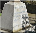
Inscription on Portwood War Memorial
The inscription on Portwood War Memorial Image (from Carrington Road); Image (from St Paul's Street) reads: TO THE GLORY OF GOD AND IN GRATEFUL MEMORY OF THE MEN OF PORTWOOD WHO FELL IN THE GREAT WAR 1914 - 1919 THEY DIED THAT WE MAY LIVE 1939 - 1945 This is the only writing on the memorial which faces the wall on the corner of Carrington Road and St Paul's Street.
Image: © Gerald England Taken: 31 Aug 2012
0.02 miles
5
Portwood War Memorial
War Memorial in the grounds of St Paul's Church at the corner of Carrington Road and St Paul's Street. The church was erected in 1851 and demolished in 1972. Image Viewed from Carrington Road Image
Image: © Gerald England Taken: 31 Aug 2012
0.02 miles
6
Portwood War Memorial
The War Memorial stands in the grounds of the former St Paul's Church Image at the corner of Carrington Road and St Paul's Street.
Image: © Gerald England Taken: 8 Sep 2016
0.02 miles
7
Portwood War Memorial
The War Memorial stands in the grounds of the former St Paul's Church Image at the corner of Carrington Road and St Paul's Street.
Image: © Gerald England Taken: 8 Sep 2016
0.02 miles
8
Carrington Road
The B6104 (formerly A560) out of Stockport. On the left in the former St Paul's churchyard Image is the Portwood War Memorial Image Hanging from the lamppost next to it is some lamppost artwork Image
Image: © Gerald England Taken: 23 Nov 2017
0.02 miles
9
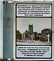
Lamppost Art: St Paul's, Portwood (West face)
Artwork on a lamppost on Carrington Road Image The text on this side reads: PORTWOOD IS A HAMLET AND SUBURB OF STOCKPORT, ADJOINING THERETO ON THE EAST, BUT IS PART OF THE TOWNSHIP OF BRINNINGTON, AND IS INCLUDED IN THE CENSUS RETURNS FOR THAT TOWNSHIP. I USED TO PLAY IN THE GRAVEYARD AS A KID. I REMEMBER SITTING ON THE BUS CRYING WHEN THEY PULLED ST PAULS DOWN, IT BROKE MY HEART. Image
Image: © Gerald England Taken: 23 Nov 2017
0.02 miles
10
Yates Street
From the grounds of St Paul's church, erected 1851, demolished 1972. Next to a piece of old church masonry is a dog-poo bin that appears to have a glove dispenser but I didn't investigate it closely enough to see if it was in working order. I suspected not.
Image: © Gerald England Taken: 31 Aug 2012
0.02 miles
  • ...