Lamppost Art: St Paul's, Portwood (West face)
Introduction
The photograph on this page of Lamppost Art: St Paul's, Portwood (West face) by Gerald England as part of the Geograph project.
The Geograph project started in 2005 with the aim of publishing, organising and preserving representative images for every square kilometre of Great Britain, Ireland and the Isle of Man.

There are currently over 7.5m images from over 14,400 individuals and you can help contribute to the project by visiting https://www.geograph.org.uk
Lamppost Art: St Paul's, Portwood (West face)
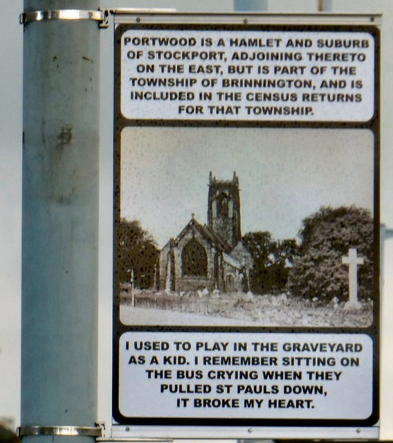
Image: © Gerald England Taken: 23 Nov 2017
Artwork on a lamppost on Carrington Road Image The text on this side reads: PORTWOOD IS A HAMLET AND SUBURB OF STOCKPORT, ADJOINING THERETO ON THE EAST, BUT IS PART OF THE TOWNSHIP OF BRINNINGTON, AND IS INCLUDED IN THE CENSUS RETURNS FOR THAT TOWNSHIP. I USED TO PLAY IN THE GRAVEYARD AS A KID. I REMEMBER SITTING ON THE BUS CRYING WHEN THEY PULLED ST PAULS DOWN, IT BROKE MY HEART. Image
Images are licensed for reuse under creativecommons.org/licenses/by-sa/2.0
Image Location
Latitude
53.416257
Longitude
-2.144398