IMAGES TAKEN NEAR TO
Lark Hall Crescent, MACCLESFIELD, SK10 1QU

Introduction

This page details the photographs taken nearby to Lark Hall Crescent, SK10 1QU by members of the Geograph project.

The Geograph project started in 2005 with the aim of publishing, organising and preserving representative images for every square kilometre of Great Britain, Ireland and the Isle of Man.

There are currently over 7.5m images from over14,400 individuals and you can help contribute to the project by visiting https://www.geograph.org.uk

Image Map


Images are licensed for reuse under creativecommons.org/licenses/by-sa/2.0
Notes
  • Clicking on the map will re-center to the selected point.
  • The higher the marker number, the further away the image location is from the centre of the postcode.

Image Listing (4 Images Found)

Images are licensed for reuse under creativecommons.org/licenses/by-sa/2.0
Image
Details
Distance
1
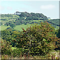
Cheshire farmland and hillside east of Macclesfield
This is a telephoto assisted image, looking east-north-east from the canal at Smyths Bridge, No 36.
Image: © Roger Kidd Taken: 8 Sep 2014
0.19 miles
2
Gorsey hillside, Higher Fence, Macclesfield
Taken from the farm track continuation of Higher Fence Road, Hurdsfield. Over the wall to the left is the service reservoir and Swans Pool is further along the track to the right.
Image: © Peter Turner Taken: 11 May 2005
0.22 miles
3
Buxton Road joins Old Buxton Road, Macclesfield
Early turnpikes were often too steep, not to go up, but to come down. In 1759 1 in 7 was considered reasonable for the old road to the right. By 1821 gradients nearer 1 in 14 were considered the normal maximum for the new road to the left, allowing lighter coaches to achieve much better overall speeds.
Image: © Chris Morgan Taken: 23 May 2016
0.23 miles
4
Buxton Old Road meets Buxton New Road
Old to the right, new to the left. The old road was the original 1759 turnpike road, replaced in 1821 by a longer but less steep route. Today it is the A537.
Image: © Graham Hogg Taken: 23 May 2016
0.24 miles