IMAGES TAKEN NEAR TO
Monks Walk, BUNTINGFORD, SG9 9DT
Introduction
This page details the photographs taken nearby to Monks Walk, SG9 9DT by members of the Geograph project.
The Geograph project started in 2005 with the aim of publishing, organising and preserving representative images for every square kilometre of Great Britain, Ireland and the Isle of Man.

There are currently over 7.5m images from over14,400 individuals and you can help contribute to the project by visiting https://www.geograph.org.uk
Image Map
Images are licensed for reuse under creativecommons.org/licenses/by-sa/2.0
Notes
- Clicking on the map will re-center to the selected point.
- The higher the marker number, the further away the image location is from the centre of the postcode.
Image Listing (54 Images Found)
Images are licensed for reuse under creativecommons.org/licenses/by-sa/2.0
Image
Details
Distance
1
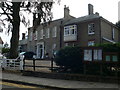
The Manor House, Buntingford
This building on Market Hill is the C18 Manor House. This is now owned by Buntingford Town Council and houses the Tourist Information Point and Heritage Centre.
Image: © Eirian Evans
Taken: 10 Sep 2009
0.13 miles
3
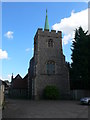
St Peter's Church, Buntingford
Formerly a chapel of ease built in the early 17th century. http://www.imagesofengland.org.uk/details/default.aspx?id=159778
Image: © Eirian Evans
Taken: 10 Sep 2009
0.14 miles
4
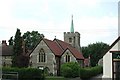
St Richard of Chichester, Buntingford, Herts
Image: © John Salmon
Taken: 16 Jun 2003
0.14 miles
5
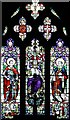
St Richard of Chichester, Buntingford, Herts - Window
Image: © John Salmon
Taken: 16 Jun 2003
0.14 miles
6
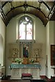
St Richard of Chichester, Buntingford, Herts - Lady Chapel
Image: © John Salmon
Taken: 16 Jun 2003
0.15 miles
7
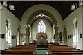
St Richard of Chichester, Buntingford, Herts
Image: © John Salmon
Taken: 16 Jun 2003
0.16 miles
8
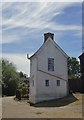
The Hoops, Chapel End, Buntingford
End-on view of a curious, long narrow building. A former pub (hence the name), converted for residential use. It stands close to the banks of the River Rib. Listing text: http://www.britishlistedbuildings.co.uk/en-159733-the-hoops-buntingford-hertfordshire
Image: © Stefan Czapski
Taken: 30 Jun 2013
0.16 miles
9
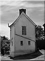
Buntingford: The Hoops, Chapel End
A curious long, narrow building, formerly - as the name suggests - a pub.
Image: © Stefan Czapski
Taken: 30 Jun 2013
0.16 miles