IMAGES TAKEN NEAR TO
Redwing Rise, ROYSTON, SG8 7XU
Introduction
This page details the photographs taken nearby to Redwing Rise, SG8 7XU by members of the Geograph project.
The Geograph project started in 2005 with the aim of publishing, organising and preserving representative images for every square kilometre of Great Britain, Ireland and the Isle of Man.

There are currently over 7.5m images from over14,400 individuals and you can help contribute to the project by visiting https://www.geograph.org.uk
Image Map
Images are licensed for reuse under creativecommons.org/licenses/by-sa/2.0
Notes
- Clicking on the map will re-center to the selected point.
- The higher the marker number, the further away the image location is from the centre of the postcode.
Image Listing (7 Images Found)
Images are licensed for reuse under creativecommons.org/licenses/by-sa/2.0
Image
Details
Distance
2

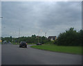
Royston Leisure Centre
The Leisure Centre is tucked away behind a new housing development but is well signposted from the A10 Melbourn Road.
Image: © Mike W Hallett
Taken: 6 Aug 2009
0.15 miles

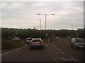
4
Roundabout on the A10 entering Royston
Looking towards the A505 exit on the left
Image: © David Howard
Taken: 13 Jun 2012
0.22 miles
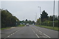
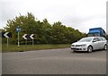
5
Roundabout on the A10 with the A505, Royston
Image: © David Howard
Taken: 13 Jun 2012
0.23 miles
7
Roundabout between the A10 and A505, Royston
Image: © David Howard
Taken: 8 May 2017
0.24 miles