IMAGES TAKEN NEAR TO
Railway Street, HERTFORD, SG14 1BJ
Introduction
This page details the photographs taken nearby to Railway Street, SG14 1BJ by members of the Geograph project.
The Geograph project started in 2005 with the aim of publishing, organising and preserving representative images for every square kilometre of Great Britain, Ireland and the Isle of Man.

There are currently over 7.5m images from over14,400 individuals and you can help contribute to the project by visiting https://www.geograph.org.uk
Image Map
Images are licensed for reuse under creativecommons.org/licenses/by-sa/2.0
Notes
- Clicking on the map will re-center to the selected point.
- The higher the marker number, the further away the image location is from the centre of the postcode.
Image Listing (415 Images Found)
Images are licensed for reuse under creativecommons.org/licenses/by-sa/2.0
Image
Details
Distance
1
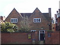
Quakers Meeting House
This not very impressive building is: The Religious Society of Friends (Quakers) Meeting House.
This Grade 2 listed building dated 1670 is the oldest Quaker meeting house built for the purpose.
Image: © Robert Timms
Taken: 28 Feb 2006
0.02 miles
2
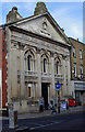
Corn Exchange and Public Hall, Hertford
Built 1857 to the designs of architect William Hill. Grade II listed building described further at this http://list.english-heritage.org.uk/resultsingle.aspx?uid=1268936.
Image: © Jim Osley
Taken: 26 Sep 2013
0.03 miles
4

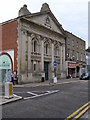
Hertford Corn Exchange
The Hertford Corn Exchange was built in 1857 on the site of the old Butchers Market.
Now it is a venue for entertainment events, including rock concerts.
Image: © mike smith
Taken: 12 Mar 2011
0.04 miles
5

Hertford : former post office
Post office from 1890. Architect H Johnson,
Image: © Jim Osley
Taken: 11 Oct 2023
0.04 miles
6
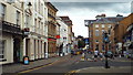
Fore Street, Hertford
Fore Street in the centre of Hertford. Hertford is a historic market town.
Dark clouds are gathering in the sky, threatening rain which started falling a few minutes after this picture was taken.
Image: © Malc McDonald
Taken: 3 Aug 2013
0.05 miles
7
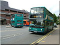
Hertford Bus Station
The bus station in Bircherley Green (sometimes spelt "Bircherly Green" on some road signs) with Arriva East Herts & Essex Dennis Trident double decker 5427 departing for Waltham Cross on route 310. In the background are similar vehicle 5428 and brand new Centrebus Optare Solo single decker 322 (YJ10EYO).
The odd name of Bircherley Green is thought to be a corruption of Butchery Green, as this was the part of the town where local butchers plied their trade in mediaeval times.
Image: © Rob Candlish
Taken: 12 Jul 2010
0.05 miles
8
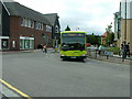
Bircherley Street, Hertford
Arriva East Herts & Essex Green Line coach number 3907 turning out of Bircherley Street and into Railway Street, with the bus station in the background, past a mis-spelt road sign. "Birchely" should actually read "Bircherley".
Image: © Rob Candlish
Taken: 26 Jul 2010
0.05 miles
9
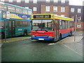
Hertford Bus Station
TrustLine DPL1 (LN03AYL), a Plaxton bodied Dennis Dart SLF, on route 351 to Bishop's Stortford. Bircherley Court sheltered accommodation is in the background.
The destination blind has Stanstead Abbotts incorrectly shown as "Stanstead Abbots", a common spelling mistake even seen on some road signs.
Image: © Rob Candlish
Taken: 10 Jan 2005
0.05 miles