IMAGES TAKEN NEAR TO
The Chase, WARE, SG12 9TN
Introduction
This page details the photographs taken nearby to The Chase, SG12 9TN by members of the Geograph project.
The Geograph project started in 2005 with the aim of publishing, organising and preserving representative images for every square kilometre of Great Britain, Ireland and the Isle of Man.

There are currently over 7.5m images from over14,400 individuals and you can help contribute to the project by visiting https://www.geograph.org.uk
Image Map (Loading...)


Getting Data...Please wait
Leaflet Map data © OpenStreetMap
Images are licensed for reuse under creativecommons.org/licenses/by-sa/2.0
Notes
- Clicking on the map will re-center to the selected point.
- The higher the marker number, the further away the image location is from the centre of the postcode.
Image Listing (36 Images Found)
Images are licensed for reuse under creativecommons.org/licenses/by-sa/2.0
Image
Details
Distance
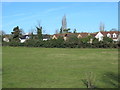
3
Field between the New River and Lower Road, SG12
Image: © Mike Quinn
Taken: 14 Jan 2015
0.14 miles
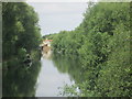
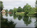
4
The New River between Lower Road and Amwell Hill, SG12 (3)
Image: © Mike Quinn
Taken: 14 Jan 2015
0.16 miles
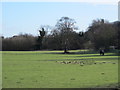
5
The New River east of Amwell Hill, SG12 (2)
Image: © Mike Quinn
Taken: 14 Jan 2015
0.16 miles
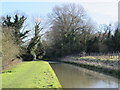
7
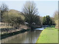
The New River between Lower Road and Amwell Hill, SG12
See Image
Image: © Mike Quinn
Taken: 14 Jan 2015
0.16 miles
8
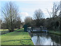
Sluice on the New River between Lower Road and Amwell Hill, SG12
See also Image
Image: © Mike Quinn
Taken: 14 Jan 2015
0.17 miles
9
The New River between Lower Road and Amwell Hill, SG12 (2)
See Image
Image: © Mike Quinn
Taken: 14 Jan 2015
0.17 miles
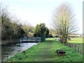
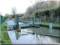
10
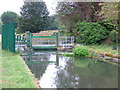
Sluice on the New River
This sluice near Great Amwell is used to control the flow of water in the New River. On certain large scale Ordnance Survey maps it is incorrectly marked as a footbridge. As can be seen it is heavily fenced and there is no public access from the riverbank.
Image: © Rob Candlish
Taken: 25 Jul 2010
0.17 miles