
IMAGES TAKEN NEAR TO
Sutton Court, Crane Mead, WARE, SG12 9FH
Introduction
This page details the photographs taken nearby to Sutton Court, Crane Mead, SG12 9FH by members of the Geograph project.
The Geograph project started in 2005 with the aim of publishing, organising and preserving representative images for every square kilometre of Great Britain, Ireland and the Isle of Man.

There are currently over 7.5m images from over14,400 individuals and you can help contribute to the project by visiting https://www.geograph.org.uk
Image Map
Images are licensed for reuse under creativecommons.org/licenses/by-sa/2.0
Notes
- Clicking on the map will re-center to the selected point.
- The higher the marker number, the further away the image location is from the centre of the postcode.
Image Listing (86 Images Found)
Images are licensed for reuse under creativecommons.org/licenses/by-sa/2.0
Image
Details
Distance

2
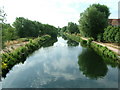
View from Tumbling Bay Bridge
Looking towards Hardmead Lock along the River Lea Navigation from Tumbling Bay Bridge. The bridge is actually hard to classify since the northern boundary of grid square TL3613 cuts diagonally across it and part of the bridge is in grid square TL3614.
Image: © Rob Candlish
Taken: 27 Jul 2010
0.04 miles
3
Lea Navigation at Tumbling Bay Bridge
Image: © Des Blenkinsopp
Taken: 13 Sep 2012
0.05 miles
4
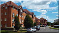
Crane Mead, Ware
Crane Mead is a new housing development in the Hertfordshire town of Ware.
Image: © Malc McDonald
Taken: 3 Aug 2013
0.05 miles
5
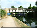
Tumbling Bay Bridge, River Lea Navigation
A footbridge just south of Tumbling Bay Weir on the River Lea Navigation.
Image: © Rob Candlish
Taken: 27 Jul 2010
0.05 miles
6
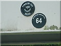
BWB plaques
British Waterways Board plaques on Tumbling Bay Bridge giving its name and bridge number. BWB always refers to this waterway as the River Lee Navigation, whereas locals always spell it Lea.
Image: © Rob Candlish
Taken: 27 Jul 2010
0.06 miles
7
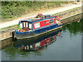
"Pug"
"Pug", a miniature narrow boat moored between Tumbling Bay Bridge and Tumbling Bay Weir on the River Lea Navigation in Ware. Normally narrow boats are at least twice as long as this one, if not more.
Image: © Rob Candlish
Taken: 27 Jul 2010
0.07 miles
9
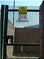
How not to display a 10 metre OS grid reference
The bottom plate on this gate leading to the electricity substation in Crane Mead, Ware is supposed to show the substation’s name and its eight digit Ordnance Survey grid reference. The first letter in the alphabetical part of the reference (“T”) is missing though.
Image: © Rob Candlish
Taken: 17 Jun 2010
0.08 miles
10
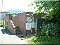
Electricity substation, Crane Mead, Ware
This electricity substation originally exclusively supplied one of the factories of D Wickham & Co Ltd, the railway engineers. It has been retained to supply new flats built on the site of the factory and is still surrounded by part of the old factory’s brickwork.
Image: © Rob Candlish
Taken: 17 Jun 2010
0.08 miles