
IMAGES TAKEN NEAR TO
Woodham Way, WARE, SG12 8DY
Introduction
This page details the photographs taken nearby to Woodham Way, SG12 8DY by members of the Geograph project.
The Geograph project started in 2005 with the aim of publishing, organising and preserving representative images for every square kilometre of Great Britain, Ireland and the Isle of Man.

There are currently over 7.5m images from over14,400 individuals and you can help contribute to the project by visiting https://www.geograph.org.uk
Image Map
Images are licensed for reuse under creativecommons.org/licenses/by-sa/2.0
Notes
- Clicking on the map will re-center to the selected point.
- The higher the marker number, the further away the image location is from the centre of the postcode.
Image Listing (68 Images Found)
Images are licensed for reuse under creativecommons.org/licenses/by-sa/2.0
Image
Details
Distance
2
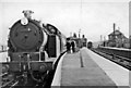
St Margarets Station, with Buntingford branch train
View southwards, towards Broxbourne and London; ex-Great Eastern Hertford East branch from Broxbourne of the Liverpool Street - Cambridge main line; junction of a branch to Buntingford (closed to passengers 16/11/64, to goods 20/9/65). The Buntingford train - which seems to have at least one passenger, is headed by N7/3 0-6-2T No. 69688.
Image: © Ben Brooksbank
Taken: 4 Apr 1959
0.03 miles
3
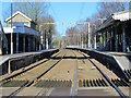
St. Margaret's station
On the Hertford East branch line between Rye House and Ware. Shows the location of Image (left, partly obscured by the canopy).
Image: © Mike Quinn
Taken: 14 Jan 2015
0.03 miles
4
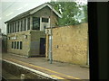
Old signal box, St Margaret's Station
The redundant signal box on the Down platform at St Margaret's seen through the window of a Class 315 unit working the 09:39 Hertford East to Liverpool Street service. This signal box closed at the same time as the ones at Hertford East and Ware when control of the signalling on the Hertford East branch was centralised at Liverpool Street Station as part of the West Anglia Route Modernisation Scheme (often known simply as WARM).
Image: © Rob Candlish
Taken: 27 Jul 2010
0.04 miles
5
The New River north of High Street, Stanstead St. Margaret's, SG12
Image: © Mike Quinn
Taken: 14 Jan 2015
0.04 miles
6
The New River north of High Street, Stanstead St. Margaret's, SG12 (3)
See Image
Image: © Mike Quinn
Taken: 14 Jan 2015
0.05 miles
7
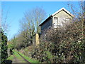
(Disused) signal box at St. Margaret's station (2)
See also Image
Image: © Mike Quinn
Taken: 14 Jan 2015
0.06 miles
9
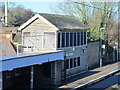
(Disused) signal box at St. Margaret's station
Image: © Mike Quinn
Taken: 14 Jan 2015
0.06 miles
10
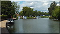
River Lee Navigation at St. Margaret's
Image: © Malc McDonald
Taken: 3 Aug 2013
0.06 miles