IMAGES TAKEN NEAR TO
Colliers End, WARE, SG11 1EG
Introduction
This page details the photographs taken nearby to SG11 1EG by members of the Geograph project.
The Geograph project started in 2005 with the aim of publishing, organising and preserving representative images for every square kilometre of Great Britain, Ireland and the Isle of Man.

There are currently over 7.5m images from over14,400 individuals and you can help contribute to the project by visiting https://www.geograph.org.uk
Image Map
Images are licensed for reuse under creativecommons.org/licenses/by-sa/2.0
Notes
- Clicking on the map will re-center to the selected point.
- The higher the marker number, the further away the image location is from the centre of the postcode.
Image Listing (30 Images Found)
Images are licensed for reuse under creativecommons.org/licenses/by-sa/2.0
Image
Details
Distance
1
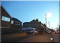
Houses on Ermine Street, Colliers End
These are the first houses coming in from the north. This is the original Roman road now bypassed by the newer A10.
Image: © David Howard
Taken: 16 Feb 2016
0.00 miles
2

Dowsett's Farm from Colliers End
View across farmland. Foreground farm equipment draws the eye towards the farm in the distance. Between, in a cutting, runs the new A10, bypassing wadesmill, High Cross and Colliers End.
Image: © Martin Addison
Taken: 4 Aug 2006
0.03 miles
4
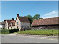
Houses, Colliers End
The house on the left is called Barnacres and dates from C17.
Image: © Bikeboy
Taken: 29 Jun 2024
0.07 miles
5

Farmhouse at Fisher's Farm, Colliers End
Grade II listed weatherboarded farmhouse: architectural description at this https://historicengland.org.uk/listing/the-list/list-entry/1102358.
Image: © Jim Osley
Taken: 30 Jul 2016
0.07 miles
6
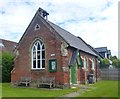
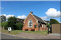
Colliers End village hall
Mid 19th-century village hall. Built in 1862 as a Church of England school - as reported at this http://www.british-history.ac.uk/vch/herts/vol3/pp347-366.
Image: © Jim Osley
Taken: 30 Jul 2016
0.11 miles
7
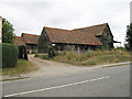
Fishers Farm
Farm Buildings adjacent to Ermine Street in Colliers End.
Image: © Martin Addison
Taken: 4 Aug 2006
0.11 miles
8
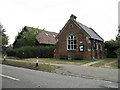
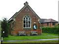
Colliers End Village Hall
This building, which bears a date of 1862, appears to be a village hall - despite the bell on the roof. The village church is further down the road. If anyone has further info - please let me know!
Image: © Martin Addison
Taken: 4 Aug 2006
0.11 miles
9

Colliers End: Former Ermine Street
Once the Roman Road Ermine Street, once the A10, this is now just the quiet bypassed main road through Colliers End. Traffic calming measures are evidently still required though.
Image: © Nigel Cox
Taken: 21 Sep 2014
0.11 miles