IMAGES TAKEN NEAR TO
Horley Road, LONDON, SE9 4LF
Introduction
This page details the photographs taken nearby to Horley Road, SE9 4LF by members of the Geograph project.
The Geograph project started in 2005 with the aim of publishing, organising and preserving representative images for every square kilometre of Great Britain, Ireland and the Isle of Man.

There are currently over 7.5m images from over14,400 individuals and you can help contribute to the project by visiting https://www.geograph.org.uk
Image Map
Images are licensed for reuse under creativecommons.org/licenses/by-sa/2.0
Notes
- Clicking on the map will re-center to the selected point.
- The higher the marker number, the further away the image location is from the centre of the postcode.
Image Listing (38 Images Found)
Images are licensed for reuse under creativecommons.org/licenses/by-sa/2.0
Image
Details
Distance
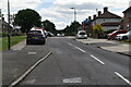
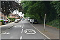
2
Framlingham Crescent, Mottingham
At the beginning of the 1930’s the London County Council bought the Court Farm estate and began the building of the 2000 home Mottingham Estate; the first houses were occupied in 1935. The estate was fairly self-contained with a sizeable shopping centre and several schools.
After the war Woolwich Council began the Coldharbour estate to the east of Mottingham Road. Built on the last remaining farmland in the L.C.C. area, it was created primarily to provide accommodation for local people made homeless by the blitz.
http://www.ideal-homes.org.uk/bromley/assets/histories/mottingham
Image: © Des Blenkinsopp
Taken: 6 Mar 2020
0.07 miles
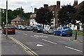
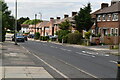
7
Kimmeridge Road, Mottingham
The Mottingham Estate is a 2,000 home housing estate developed in the 1930s by the London County Council. As well as housing, the estate included facilities such as shops and a church, both visible in this image.
Image: © Malc McDonald
Taken: 19 Mar 2011
0.11 miles
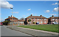
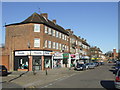
8
Lower Marvels Wood
The path heads towards Court Farm Road.
Image: © Robin Webster
Taken: 4 Feb 2012
0.12 miles
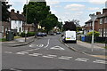
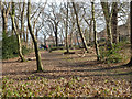
9
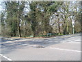
A woodland corner in SE9
This must be almost the last square within the London Postal District to be geographed. This bit of woodland is at the corner or Court Farm Road with Dunkery Road, Mottingham and within the Borough of Greenwich.
Image: © Dr Neil Clifton
Taken: 23 Mar 2006
0.12 miles
10
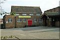
Court Farm Evangelist church hall
There is a 'Christian playgroup' held here on Thursday mornings in school term time only, according to the banner.
Image: © Robin Webster
Taken: 4 Feb 2012
0.13 miles